Contact
Provider(s):
3K camera system
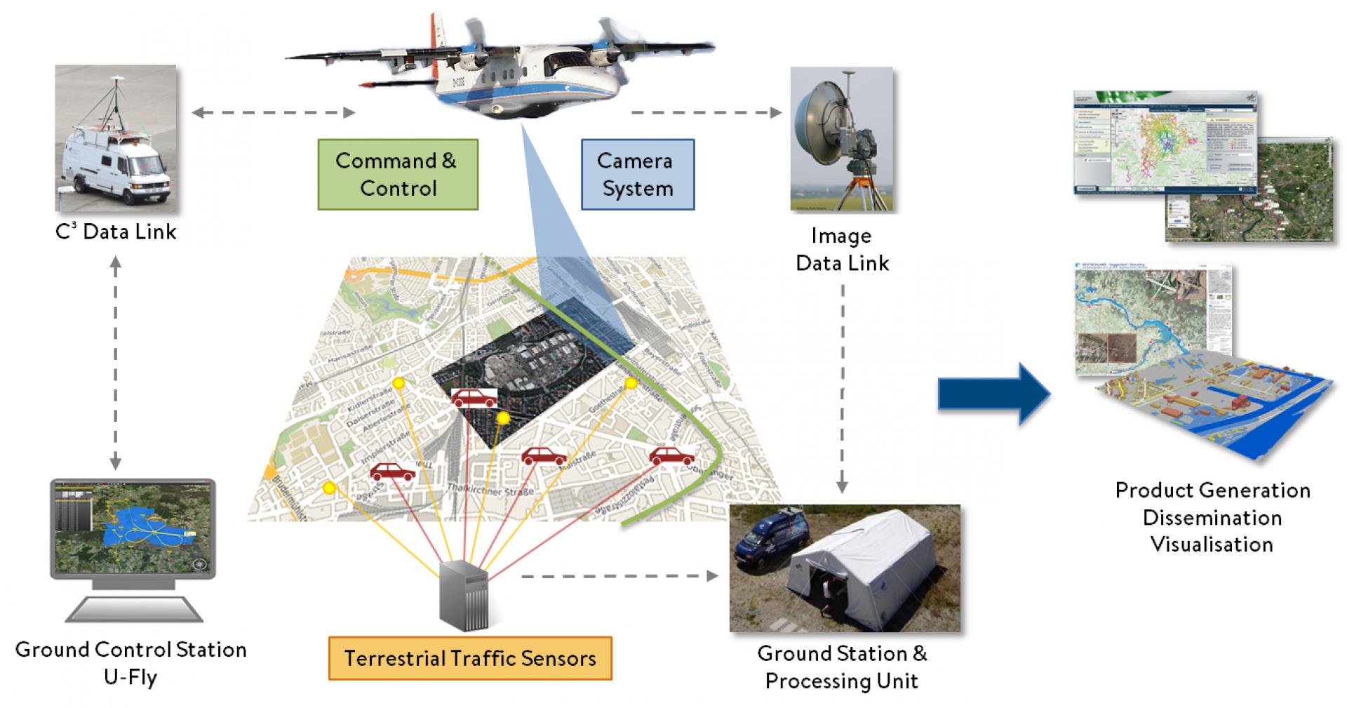
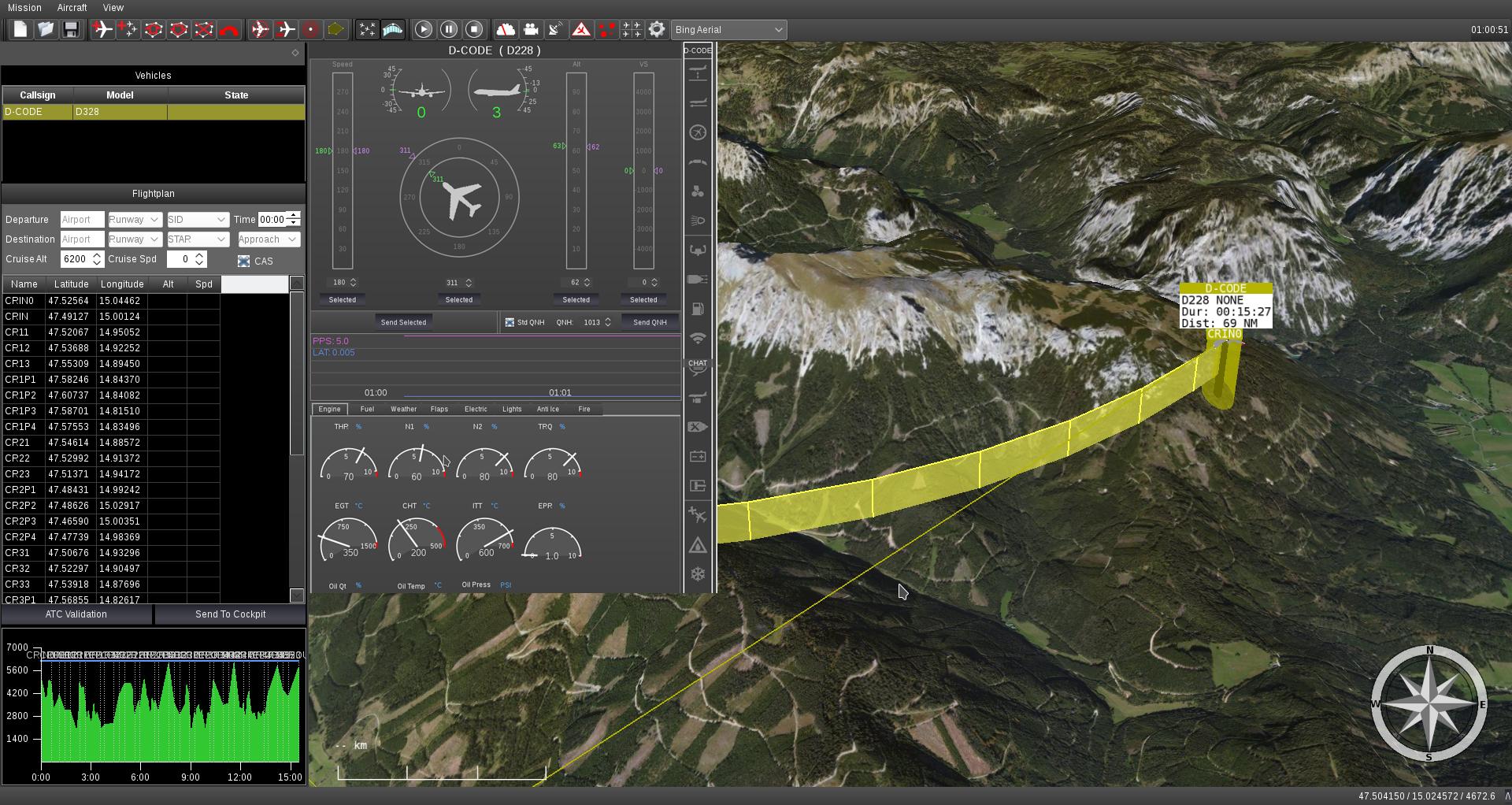
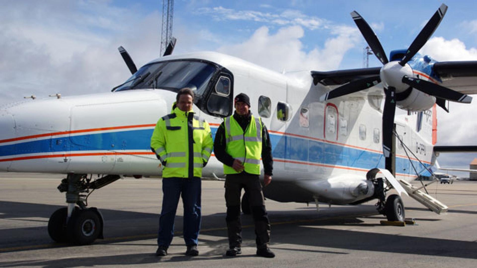
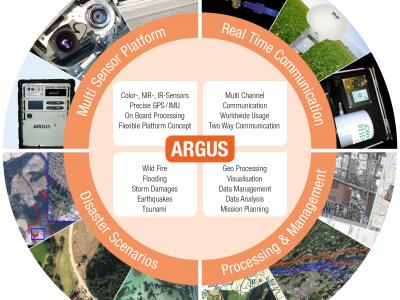
DLR's optical 3K camera system enables the acquisition and immediate processing of high-resolution aerial imagery. It is integrated into the research aircraft D-CODE, a modified Dornier Do 228 with a digital autopilot, which is operated as a Remotely Piloted Vehicle (RPV). The camera system captures - depending on the flight altitude - an area of 80 square kilometers in about two minutes, generates georeferenced aerial images and transmits the results to the ground station via a data link.
Remotely Piloted Vehicle and U-Fly
The flight path planning and remote control is executed by the ground control station U-Fly, which is connected to the Remotely Piloted Vehicle (RPV) using a data link for command, control, and communication (C3). The RPV provides aerial images and sends the data over a separate payload data link to the ground system.
Center for Satellite Based Crisis Information (ZKI)
The Center for Satellite Based Information (ZKI) is a 24/7 service and operates at national and international level. ZKI aims at rapid acquisition, processing and analysis of earth and ancillary data in order to generate up-to-date situational awareness information before, during or after a situation, humanitarian crisis or in case of major events. Main user groups are political decision makers, situation centers and relief organisations.
Based on the acquired satellite or aerial imagery as well as additional data, information layers relevant for are derived and provided for instance as geo web services and map products according to the users’ requirements using the resources of the ZKI- .
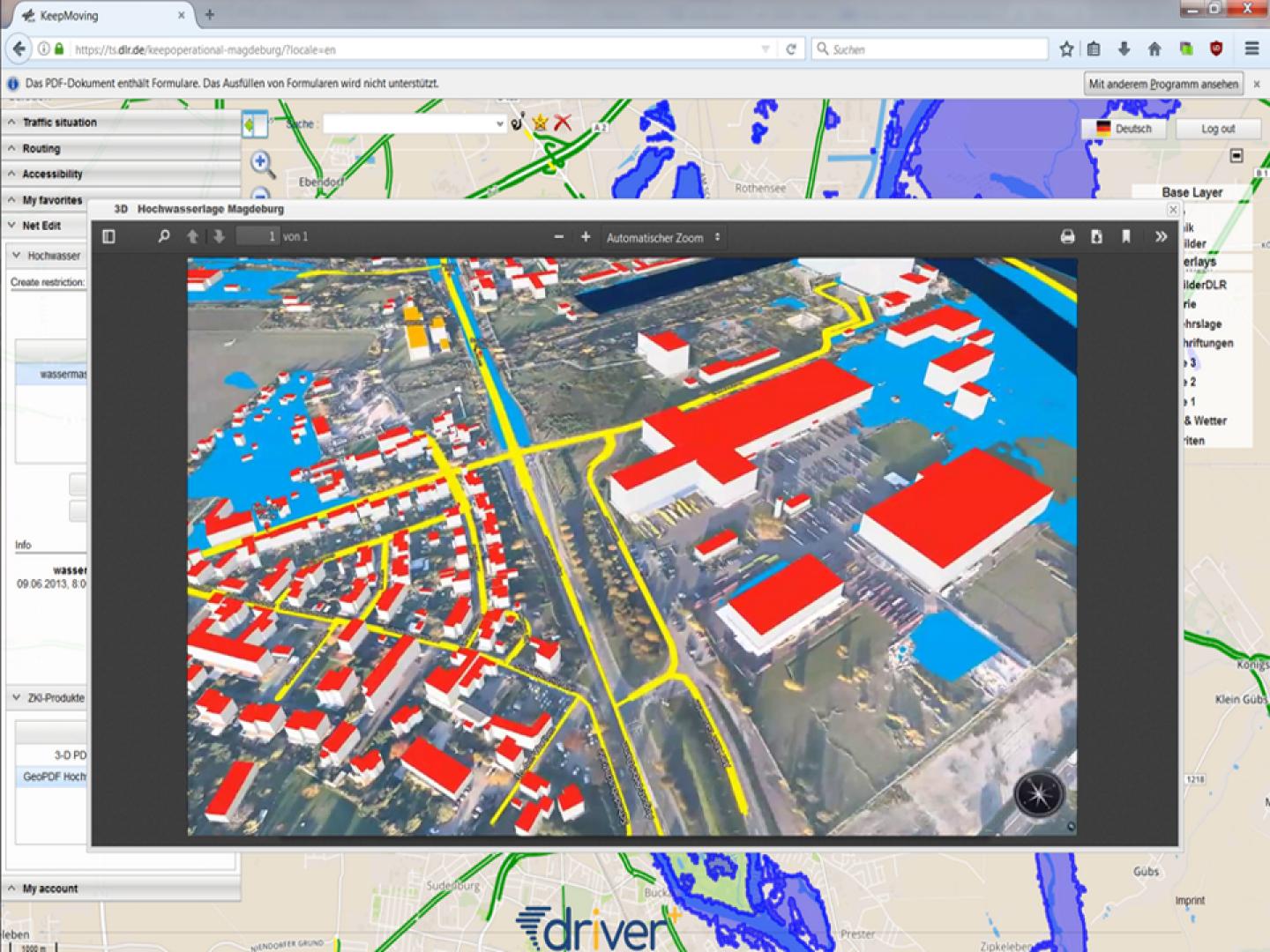
KeepOperational
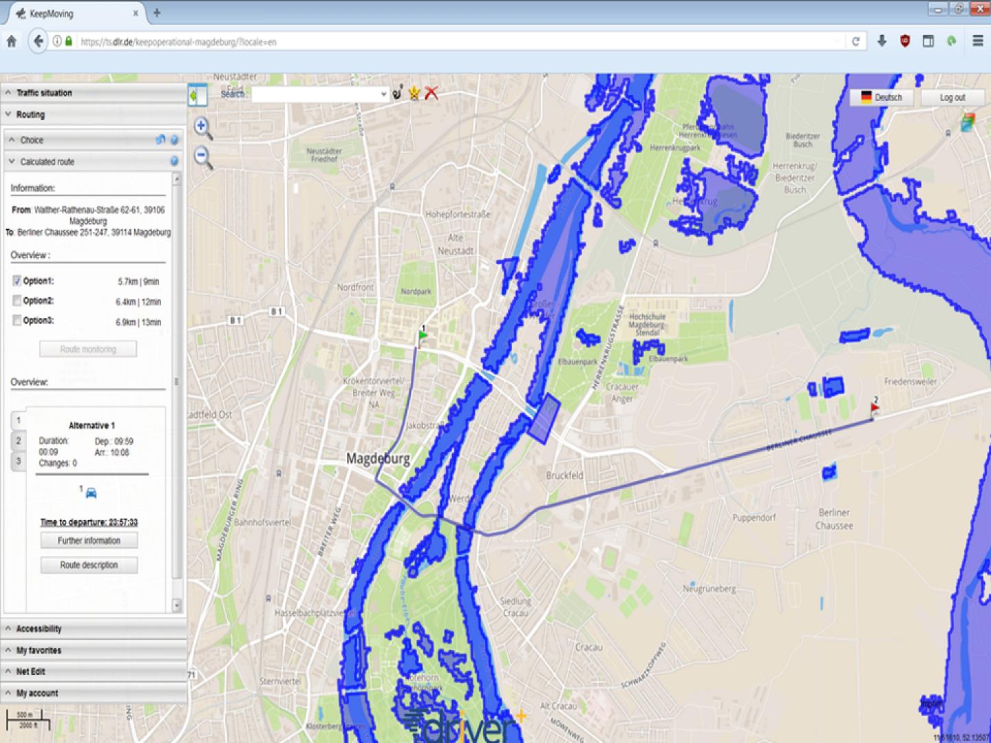
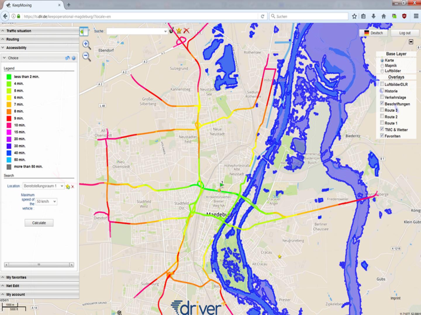
KeepOperational combines the derived information layers, together with data from terrestrial traffic sensors. KeepOperational is an extension to the DLR Traffic Data Platform. The Traffic Data Platform consists of a set of services for processing and analysis of traffic data. In combination with the information layers obtained from aerial imagery, KeepOperational provides traffic analysis and route planning capabilities on infrastructure which is affected by a crisis.
Supported Use Cases
Accessing Remote Sensing Based Situation Analyses Products
Planning of crisis response actions
Remote Sensing for Disaster Overview
References
DRIVER+ Trial 4 - The Netherlands
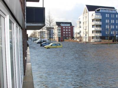
The "The Netherlands" took place in The Hague in May 2019 and focused on a flood affecting crucial parts of the Safety Region Haaglanden. The main objective of the was to find and test solutions for planning of resources, exchanging -related Information among agiencies and organizations, and planning and managing large scale evacuation of population in urban areas. The Trial has been organised as a table-top based on a simulated environment.
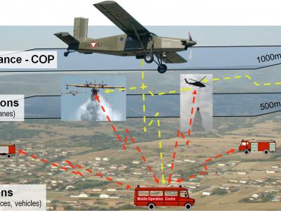
Real-time aerial imagery could significantly support situational awareness during major and area wide disasters. DLR’s solution “Airborne and Terrestrial Situational Awareness” comprises four modules to provide such a real-time aerial imaging and analysis system. Module 1 is the Ground Control Station U-Fly operating the research aircraft D-CODE as a remotely piloted vehicle (RPV). Module 2 is DLR’s 3K aerial camera system. Module 3 is the Center for Satellite based Crisis Information (ZKI) which analyses the acquired aerial imagery and generates crisis information, such as situational awareness maps. Module 4 is called KeepOperational and provides traffic analysis and route planning capabilities taking into account aerial imagery and/or ground data. The solution can be applied as a complete system or by using the individual modules as stand-alone versions. Within Trial - The Netherlands, module 3 (ZKI) and module 4 (KeepOperational) have been selected to demonstrate their capabilities. Instead of using real-time aerial imagery, simulated flood Information and existing imagery, as well as additional geoinformation (open data) were used for the table-top Trial.
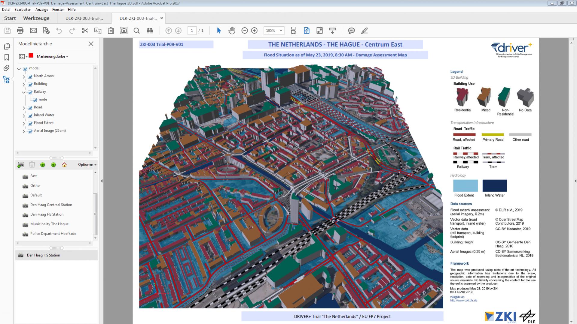
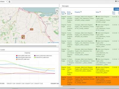
In this Trial, each Action Centre received support through information obtained from remote sensing data on the disaster extent and potentially affected buildings and infrastructure. For this purpose, ZKI provided a flood mask, as if it had been derived from aerial imagery, of the actual flood situation and disseminated it via standardised OGC visualisation and data web services. The information has been integrated in the available COP system and other solutions. Further, ZKI provided digital, interactive 2D and 3D map products that showed the extent of flooding and its impact on infrastructure in multiple areas of interest.
KeepOperational has been used by the Action Centre Police to generate traffic circulation plans, as well as for analysing the accessibility of the affected crisis area. The flood prediction provided by the solution “3DI” as well as the flood information acquired and provided by ZKI were used to adapt the routing requests based on non-accessible areas. The Action Centre Police was also able to add their own information (for example traffic jams or blocked roads reported by units in the field) to the KeepOperational .
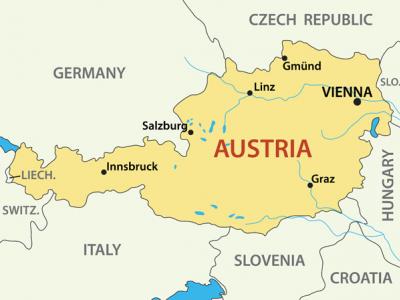
DRIVER+ Trial 3 - Austria
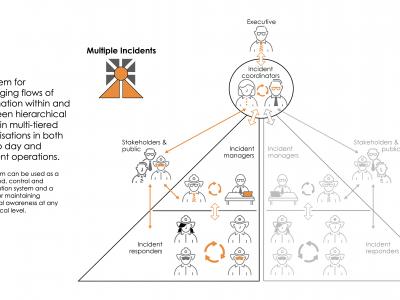
The main objective of 3 was to find solutions overcoming shortcomings and limitations in the management and monitoring of spontaneous as well as affiliated volunteers on the crises scene in terms of location, tasking, capabilities and duration of operations but also ability to merge and synthesise disparate data sources and models in real time (e.g. visualisation of resources, spreading models, tactical situation, critical assets map, damaged objects/infrastructure etc.) to support incident commander decision making and exchanging -related information among agencies.
Documentation
Similar Solutions


 |
Portfolio of Solutions web site has been initially developed in the scope of DRIVER+ project. Today, the service is managed by AIT Austrian Institute of Technology GmbH., for the benefit of the European Management. PoS is endorsed and supported by the Disaster Competence Network Austria (DCNA) as well as by the STAMINA and TeamAware H2020 projects. |