Contact
Provider(s):
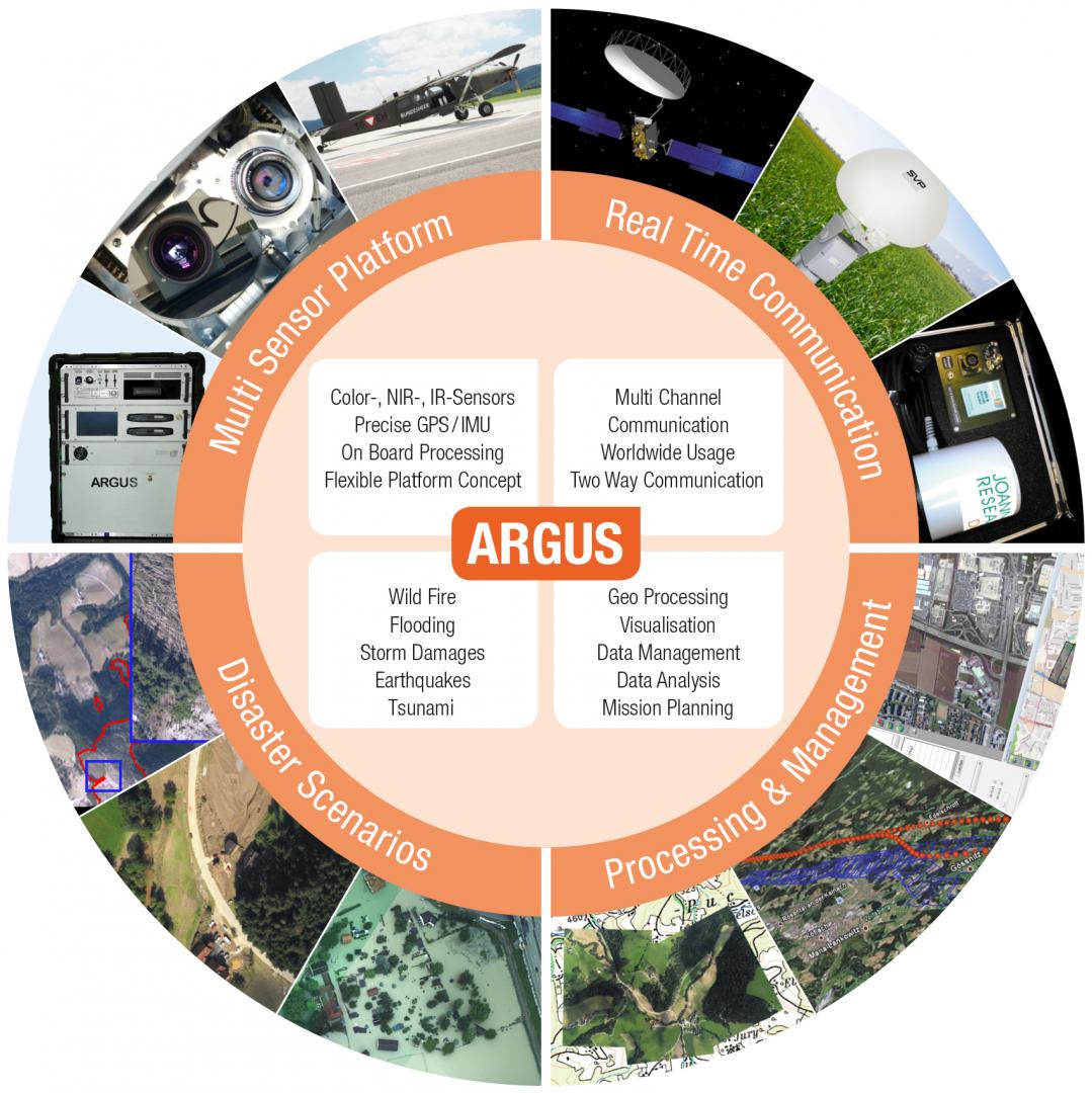
ARGUS is a system which includes airborne acquisition of multi-sensor image data and rapid mapping capabilities. It thus can provide flexible and significant support in case of situations and assist in-situ analysis as well as management activities. The system follows the demand of teams to react quickly and efficiently when natural disasters like forest fires, flooding, earthquakes, landslides, mudflows etc. occur. It enables image acquisition in near real-time and the to receive an up-to-date operational picture of the whole situation in order to increase awareness. Target groups, such as civil protection agencies, fire brigades or national defence agencies acting in support missions, require up-to-date and high quality in-situ data as well as proper analysis in order to guide and control task forces in an efficient way.
Supported Use Cases
Flooding Monitoring
 |
Portfolio of Solutions web site has been initially developed in the scope of DRIVER+ project. Today, the service is managed by AIT Austrian Institute of Technology GmbH., for the benefit of the European Management. PoS is endorsed and supported by the Disaster Competence Network Austria (DCNA) as well as by the STAMINA and TeamAware H2020 projects. |