Contact
Provider(s):
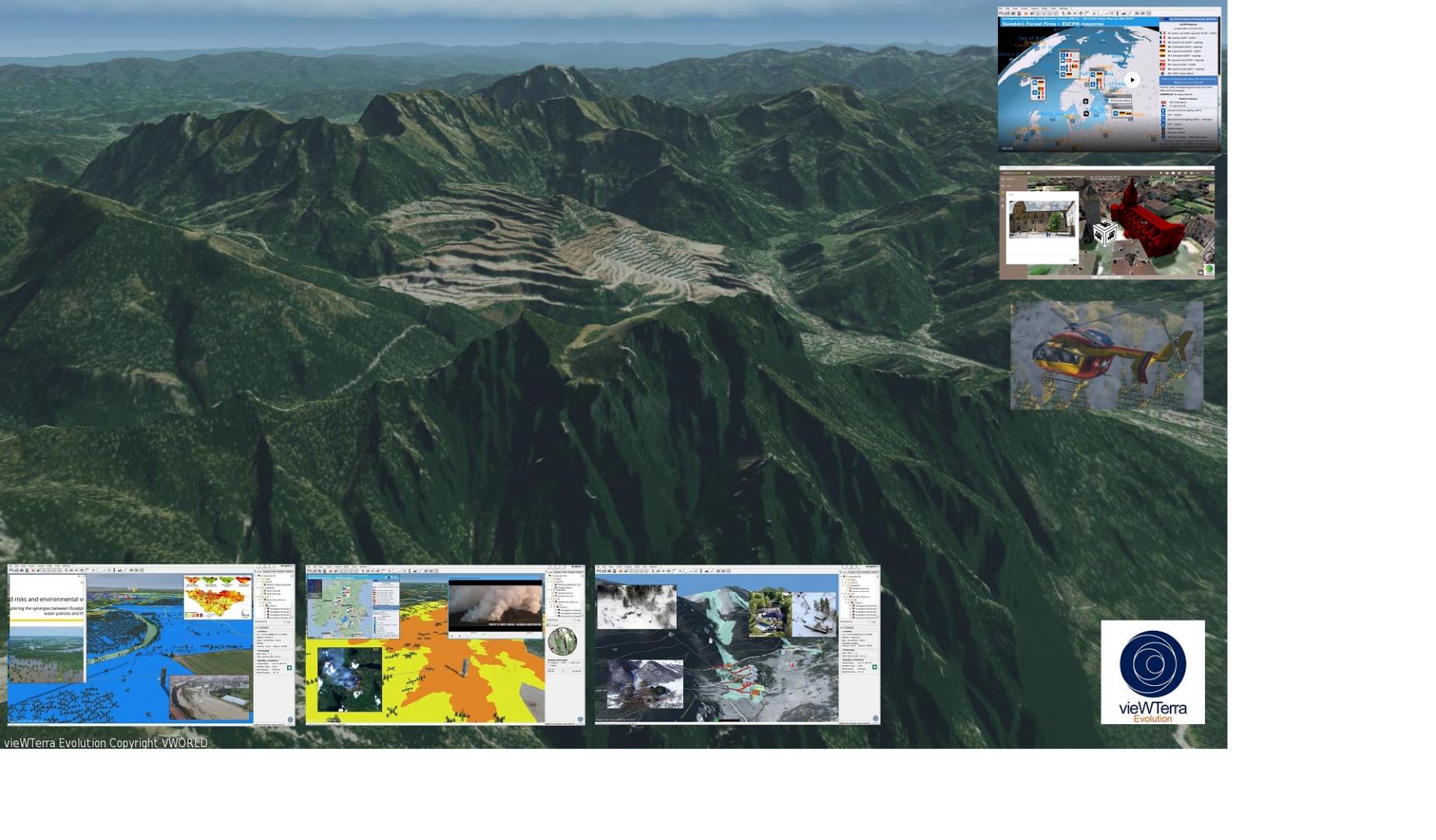
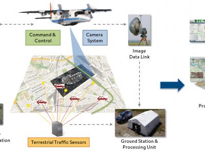
vieWTerra Evolution, vieWTerra Mobile and vieWTerra Base from VWORLD form a combined “GIS & Simulation” suite of products allowing responders to rapidly build a virtual 4D representation (3D synthetic environment+ Time dimension) of any potential area on Earth, available both on desktop PC (off-line/on-line product) and mobile devices (Web browser application for PC, tablets and smartphones). These solutions provide a Common Operational Picture to both the Command Center and the rescue units out in the field.
ABOUT THE SOLUTION:
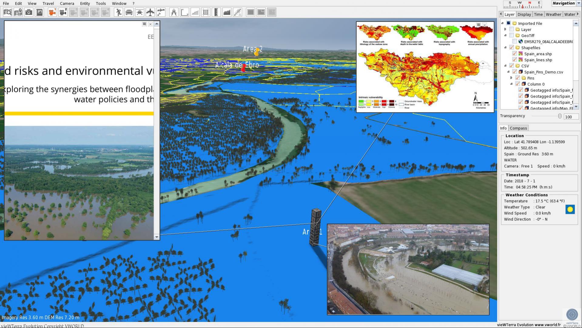
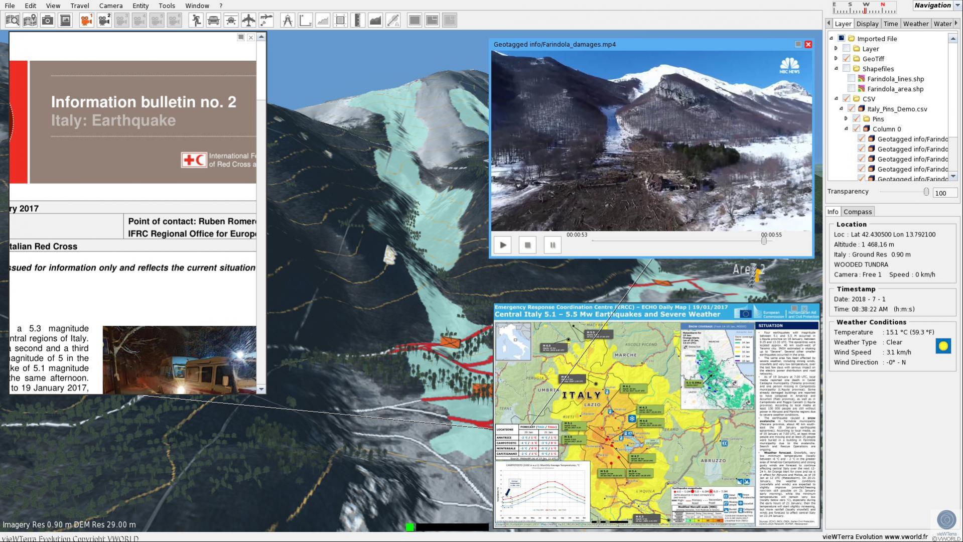
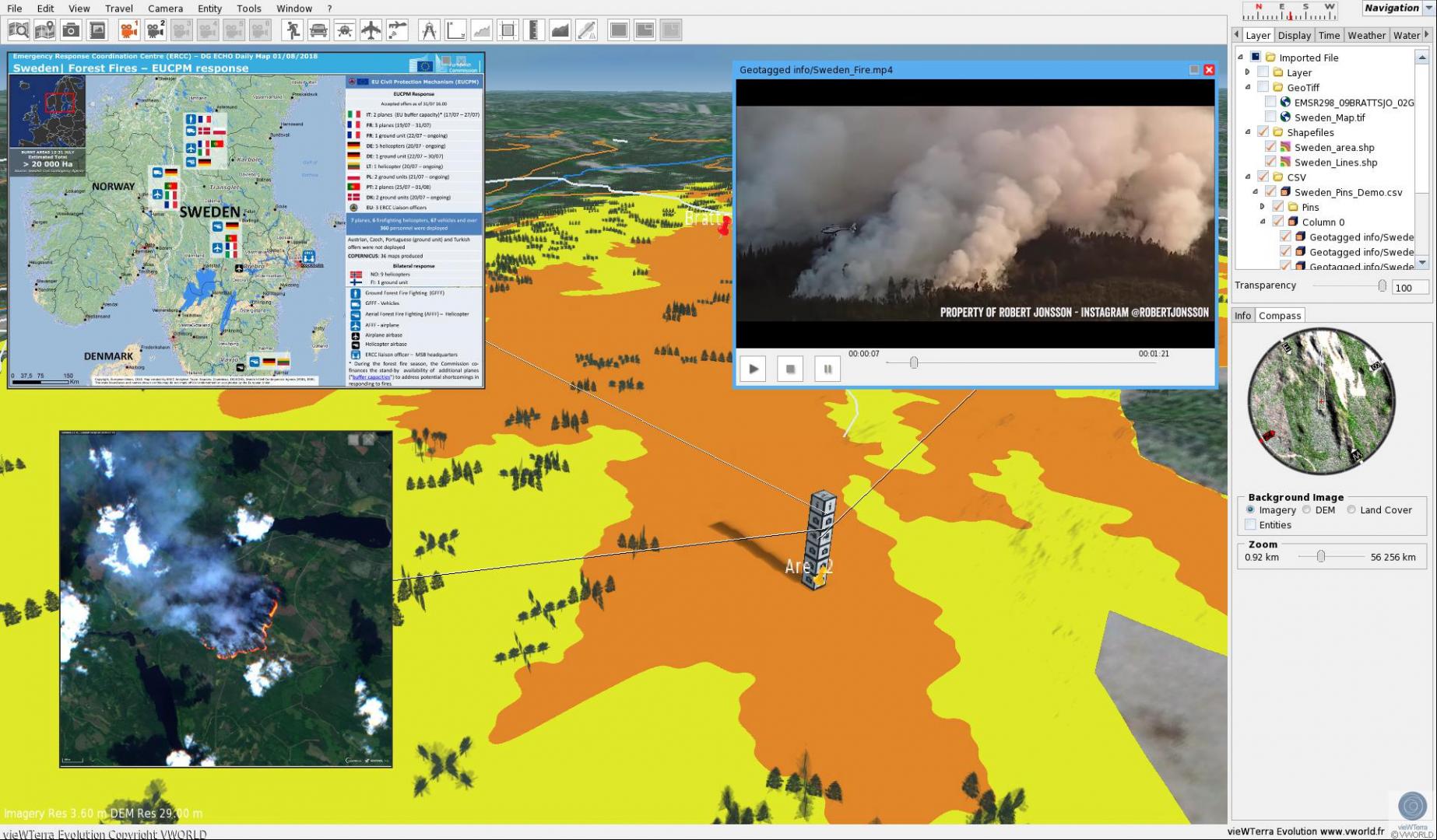
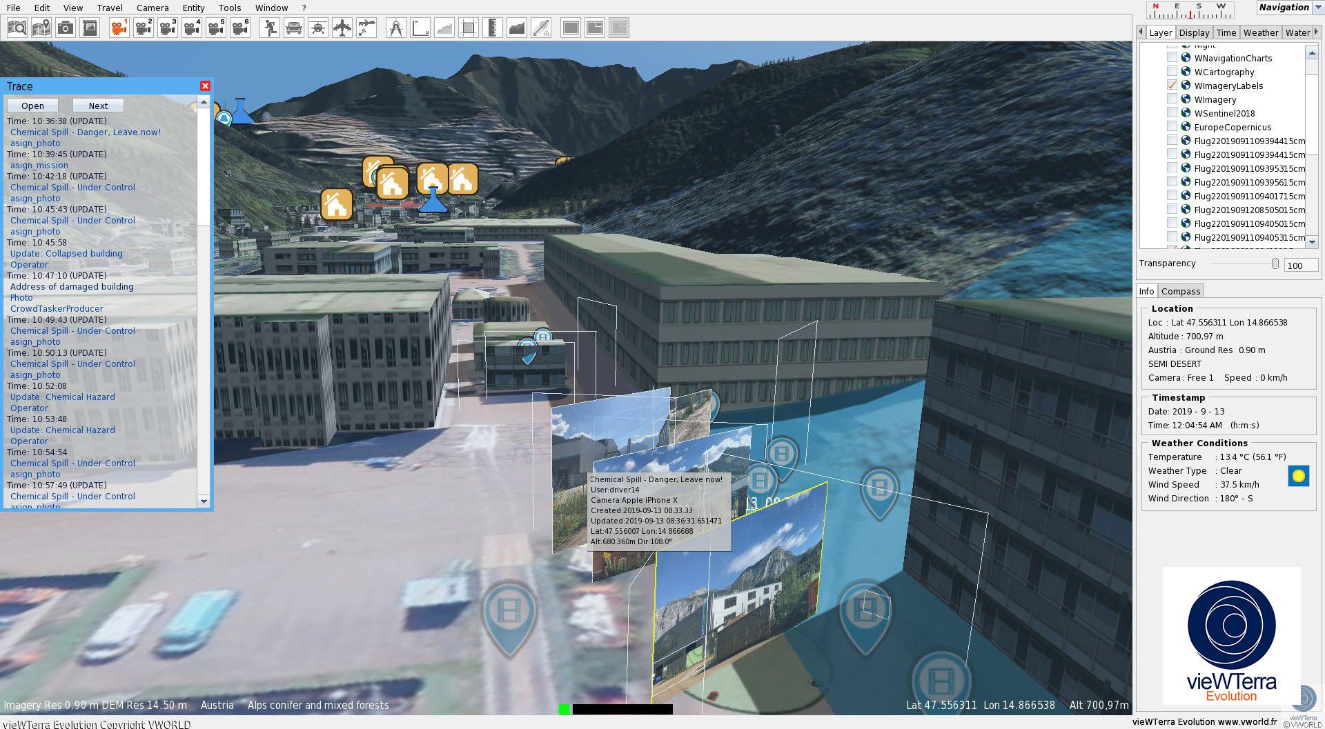
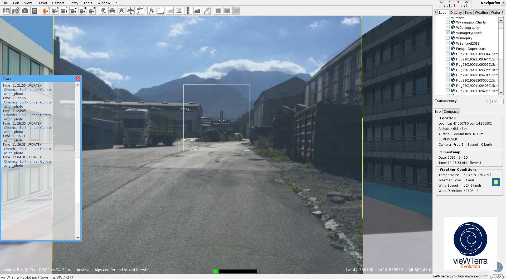
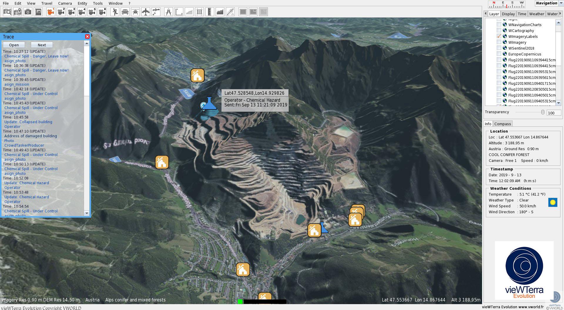
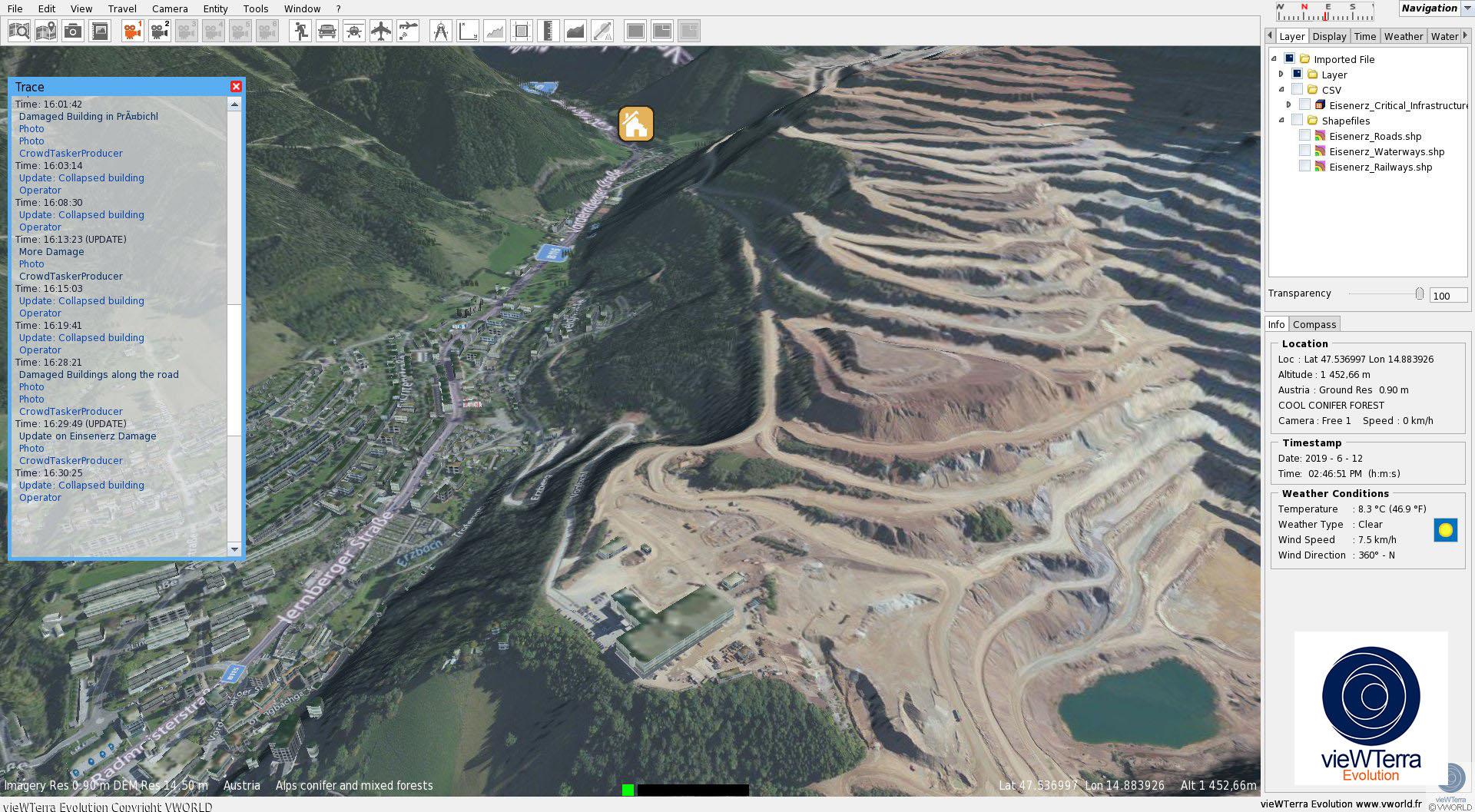
vieWTerra Evolution is a 4D Earth Viewer as well as a data & assets integration and development platform. It can be used to model any type of 3D scene on Earth and create scenarios at their real-world location to simulate events in the Crisis phase, and to serve as global repository for building a custom Earth-wide GIS, either used perfectly off-line (on PC, laptops or Windows tablets, using cache for possible use out-in-the-field also), or ported on an on-line architecture (Internet or Intranet private server), in order to allow the sharing of information and assets between multiple stakeholders in the Crisis phase. Exchange of information can be conducted both ways, either to and from the field notably allowing photos taken on-site, using commonly-used smartphones/tablets, to be shared with the Command Center.
vieWTerra Evolution presents an ellipsoidal model of the Earth defined at a certain level of resolution (vieWTerra Base global 29m Imagery, 90m DEM- upcoming 2020: 29m DEM, 29m Land Cover database) and allows its users to integrate accurate Imagery, DEM and Land Cover datasets up to 45cm resolution anywhere on the Globe, without any area coverage limitations.
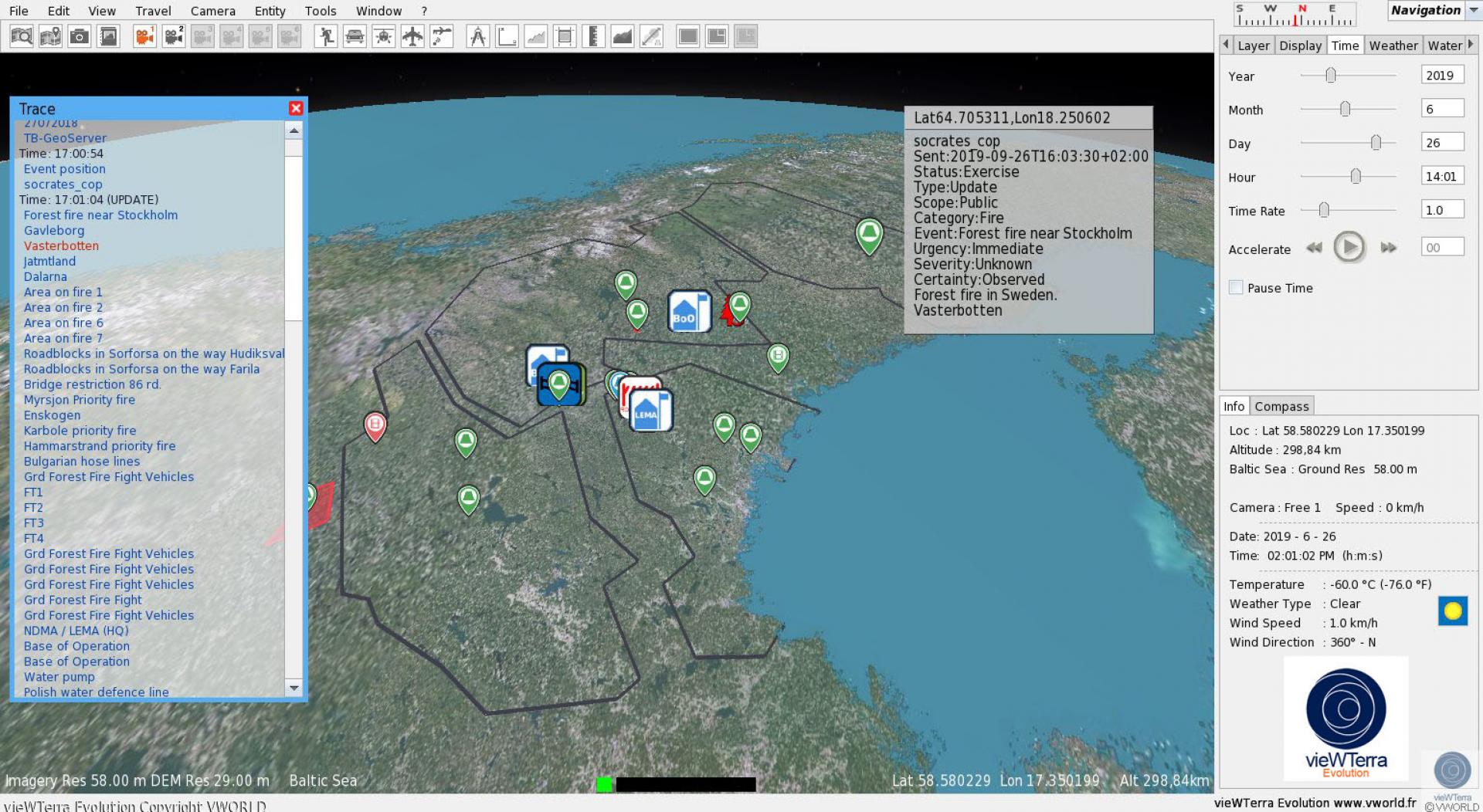
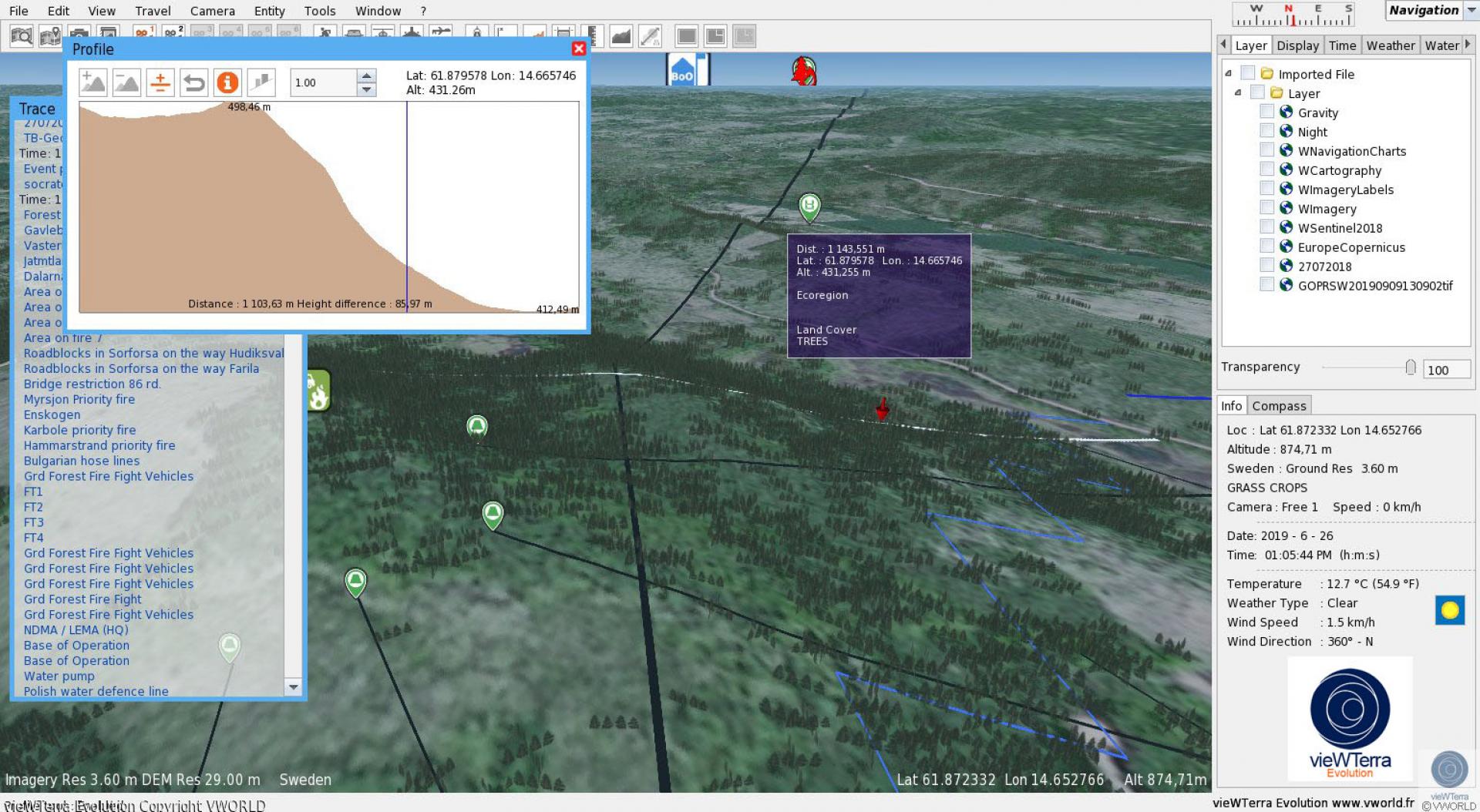
Already offers continuous time of day (real-time shadows and lights) and dynamic weather simulation capabilities, which could be tied to current day weather data feed.
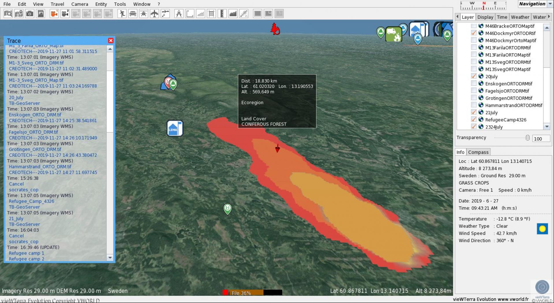
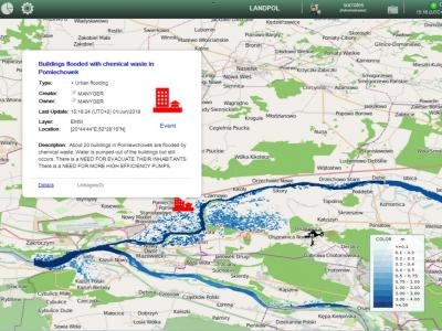
Provides easy-to-use drag-and-drop functionalities for adding one's own data and assets from multiple sources (3D objects/ buildings, dynamic and user-controllable entities such as rescue units across all domains, e.g. helicopters, drones, fire trucks, vessels etc., which can be used either to create scenarios or represent movements of live assets-using communication protocols; shapefiles or 2D drapes defining e.g. heatmaps,
maps, spreading models, tactical situation...; photogrammetry or LiDAR-acquired 3D terrain or objects models; custom labels, information or instructions under PDF form, on-site taken photos, videos or audio recordings…), all within the same software.
Alternatively can be used also to access any Open Geospatial Consortium standard WMS/WMTS data streams, displayed as additional layers over the vieWTerra virtual Globe, such as Open Street Map cartography, Copernicus web services 2,5m Imagery or Copernicus
Management Service assets such as EFFIS fire forecasts, etc.
vieWTerra Evolution also offers real-time orthorectification and draping of newly-acquired Imagery from satellite or drone acquisition as state-of-the-art prototype module for rapid mapping and updating of the terrain database.
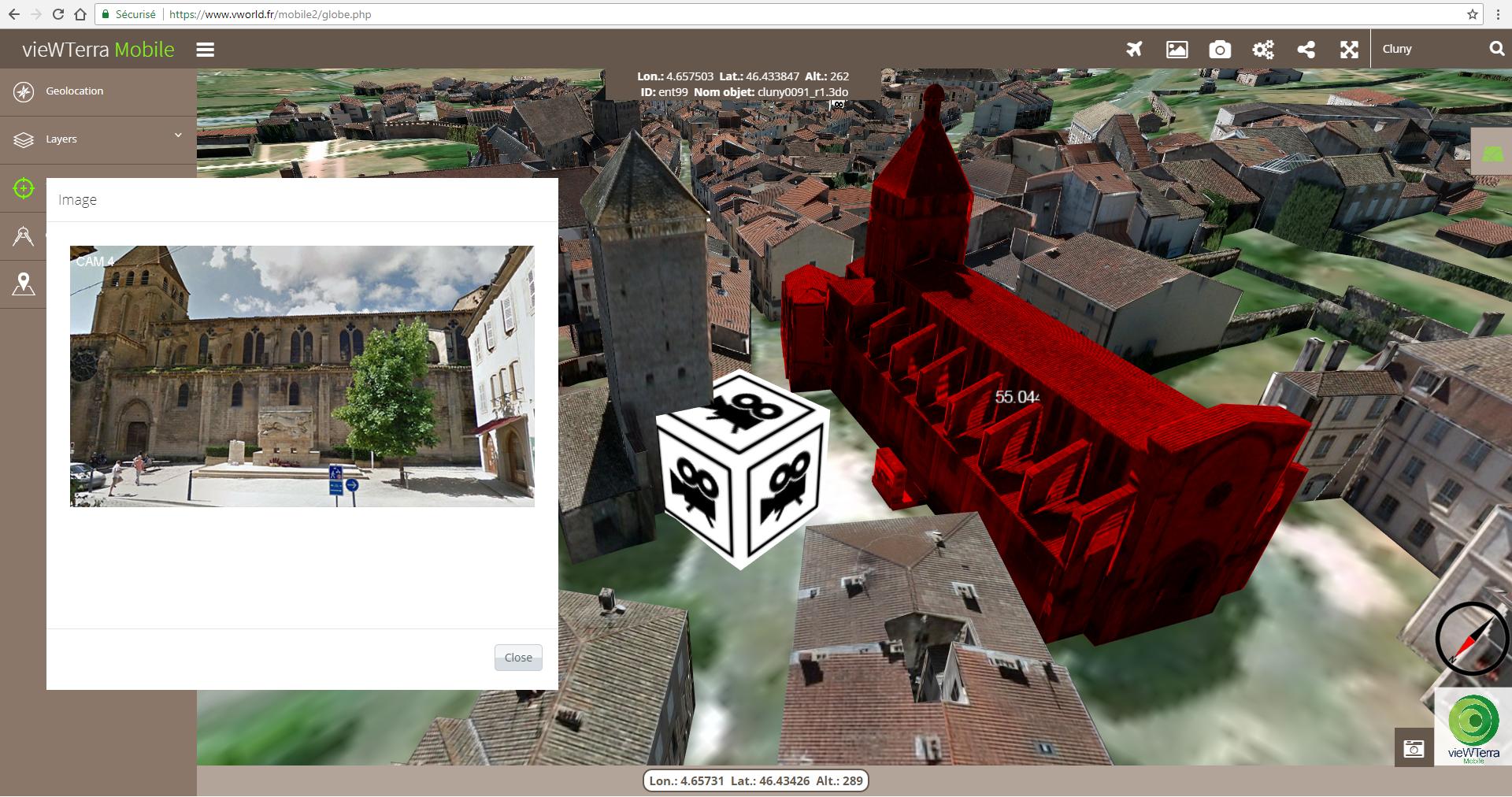
vieWTerra Mobile complementary application allows the display of the same data and assets database in a mobile, Internet or Intranet- based HTML5 Viewer application (cross-plaform: PC/Mac, tablet, smartphones).
WHAT DOES THE SOLUTION BRIDGE?
- Limitations in the ability to model large areas (preparedness phase) and provide instant mapping ( phase)
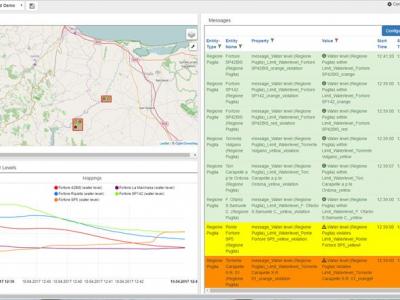
- issues: notably by incorporating disparate data sources and allowing data sharing between multiple stakeholders, since all datasets are merged in a single « One World » environment and encapsulated a single database
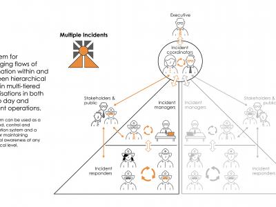
- Lack of Common Operational Picture: brings 3D rendering (very cognitive and interactive real-world like environment) in support of the conduct of operations both to decision-makers and commanders in the Command Center and to response units out in-the-field
Supported Use Cases
3D and scenario modelling
Determine area of operations
Develop and sustain COP
Display situational awareness
Provide CCIM technology support
Provide situational awareness, share COP
Support C3 decision-making
Use of virtual reality to enhance preparedness for large scale evacuation
References
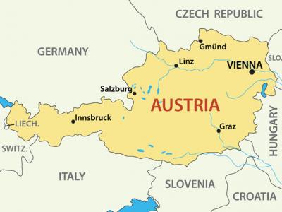
DRIVER+ Trial Austria
DRIVER+ Austria was organised by the Austrian Red Cross (ARC) together with the Austrian Institute of Technology (AIT).
It was conducted as a multi-day field under the framework (and in parallel) of a Large Scale European Civil Protection in Eisenerz, Austria.
THE : A HEAVY EARTHQUAKE IN THE LOCAL REGION OF EISENERZ
The central area of Austria has been struck by a heavy earthquake and subsequent heavy rains.
The local region of Eisenerz (in Styria, Austria) is one of the most affected with missing persons, casualties, collapsed buildings, blocked roads, and endangered industries working with hazardous substances.
Inhabitants have left their houses being afraid of aftershocks and collapsing of buildings. They have to spend the next days outdoors due to the lack of temporary shelter and blocked roads.
Similarly, there is a disruption of lifelines such as water, food, shelter, transportation and medical care. Electricity and mobile networks are severely damaged.
All local and national organizations have been deployed on site (Austrian Red Cross, fire brigades, police and the army); however, due to the extension of the affected area and overwhelmed national capacities, the union civil protection mechanism was activated. A request of international assistants was activated with regards to medical treatment, water purification as well as search and rescue.
Due to the difficulty to access the affected area and considering the impact of the , there is an urgent for humanitarian assistance and .
A large amount of volunteers and rescue equipment is needed to deal with the increasing number of affected people i.e. search and rescue, shelter, medical care, water food and transportation.
Additionally, there is also an urgent need for the management of spontaneous volunteers.
THE ACTORS INVOLVED
The requires a commitment of stakeholders from different management levels and from all the agencies participating in the response:
- Austrian Red Cross
- Austrian Fire Brigades
- Police
- Army
- Decision makers and authorities
Other response organizations from neighbouring countries were expected to participate following the procedures from the union civil protection mechanism (UCPM). The exercise was also serve as testing environment for introduction and establishment of standard operating procedures (SOPs), standards and concepts, of the UCPM within central European region.
Actions were taken by the stakeholders in a realistic information environment, based on currently available means, plans, rescue procedures and good practices of participants
DRIVER+ Final Demonstration
The Final Demonstration (Final Demo) was the last , concluding the series of DRIVER+ Trials. It also provided an opportunity to showcase the main outcomes of the Project.
The event had been tailored to the needs of the main End-User – the Emergency Response Coordination Centre (ERCC) – and was conducted in accordance with the project’s methodology. The ERCC, situated in Brussels, was created in 2001, following the European Parliament Decision on Union Civil Protection Mechanism (UCPM). It is the highest Management coordination body in the European Union. The primary aim of the UCPM is to strengthen cooperation between Participating States – Members States and others affiliated in the UCPM – in the field of civil protection, in order to respond to disasters as effectively and synergistically as possible. Since 2001, the UCPM has been activated over 300 times and each year the number of activations is growing. New innovative solutions, improving the realisation of the Union Civil Protection Mechanism tasks, are continually being sought.
The ERCC monitors the situation from Brussels and has an expert support group deployed on the ground called the European Union Civil Protection Coordination Team (EUCPT). The main role of the EUCPT is to coordinate activities in the field by liaising between the UCPM Modules and the Local Management Authority (of the country stricken by a disaster), in order to provide a common understanding of the needs and to ensure a relevant and timely .
The Final Demo addressed the communication aspects between the UCPM components, mainly the ERCC, the EUCPT and the Modules, which are sent to the country in crisis by states affiliated within the scope of the UCPM. The main areas addressed were:
• reporting on the operational activities from the field to the ERCC;
• information exchange among Team Leaders of the Modules, and the EUCPT;
• geo-information support for situation
and decision-making for Team Leaders of the Modules and the EUCPT.
1
Shortcomings in in the ability to exchange crisis-related information among agencies and .
2
Lack of a “Common Operational Picture” to integrate data sources and calculation results from different models crucial for the decision making process.
GAP 3
Limitations in the ability to merge and synthetise disparate data sources and models (e.g. historic events, spreading models, tactical situation, critical assets map) in (near) real time to support decision making.
FINAL DEMO SCENARIO
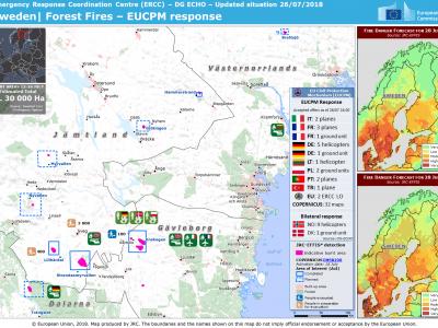
MAJOR FOREST FIRE- EUCPM ACTIVATION
The fictional country Driverstan, situated outside the European Union but relatively close, is a democratic republic, however, is not yet as fully developed as the EU countries – it is lacking solid structures, a stable economy and a strong . The of the Final Demo focused on largescale forest fires in a rural area with potential developments, causing a complex humanitarian crisis.
Due to high temperatures and lack of rainfall during recent weeks, the number of forest fires is multiplying in the country. Domestic capabilities are not sufficient to cope with the fires alone. Driverstan creates a Request for Assistance (RfA) that is shared with the ERCC, EU Member States and affiliated countries. The Union Civil Protection Mechanism was activated and offer of support from different countries was gathered.
The expected to trigger an exchange of information between the ERCC, EUCPT and the National Disaster Management Authority (NDMA). The use of the DRIVER+ selected innovative solutions, tested alongside the standard operational procedures of the ERCC, EUPCT and Modules, demonstrated the potential added value of the solutions in such a situation.
Documentation
Similar Solutions

 |
Portfolio of Solutions web site has been initially developed in the scope of DRIVER+ project. Today, the service is managed by AIT Austrian Institute of Technology GmbH., for the benefit of the European Management. PoS is endorsed and supported by the Disaster Competence Network Austria (DCNA) as well as by the STAMINA and TeamAware H2020 projects. |