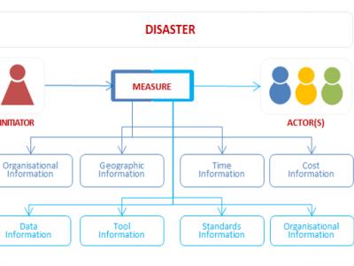
As an alternative to searching directly for solutions, you can also search for CM gaps and find out which solutions address the gaps you are interested in.
PDF export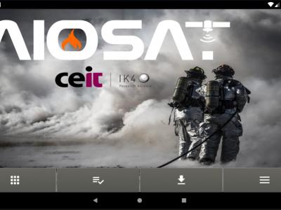
AIOSAT
The AIOSAT (Autonomous Indoor / Outdoor Safety Tracking System) system will allow the team/brigade commander to track the location, including a confidence margin on the location, answering a necessity of the emergency services.
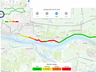
Real Time Flood Risk Assessment Viewer
In the Real Time Flood Risk Assessment viewer risk information is presented for the actual situation (using measurements) and upcoming day’s using forecasts, uses a single point of truth of information for all the daily operational working processes.
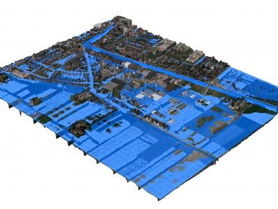
3Di - Water Management
3Di is a cloud-based versatile water management instrument that enables flood forecasting and risk mapping.
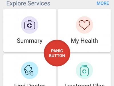
eHealthPass
eHealthPass is a patient-cantered solution that allows patients to securely carry and manage their complete medical information via their phone. At a time of crisis, it provides the HealthCare professionals with timely access to vital patients' medical in
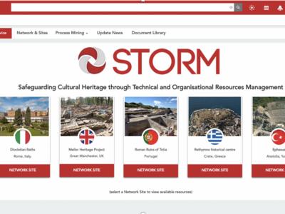
STORM
STORM Dashboard provides collaborative and operative services to better act in the prevention and intervention phases of a disaster
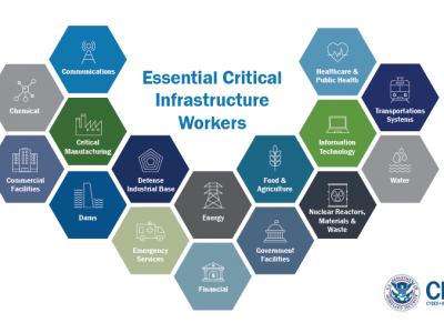
US Guidance on the Essential Critical Infrastructure Workforce during COVID-19
Guidance for identifying the critical infrastructure sectors and the essential workers needed to maintain the critical services and functions during the COVID-19 pandemic response

European Mobile Laboratory Inventory Database
European Mobile Laboratory Inventory Database

Google Forms
Google Forms is a survey administration software included as part of the free, web-based Google Docs Editors suite offered by Google. The service also includes Google Docs, Google Sheets, Google Slides, Google Drawings, Google Sites, and Google Keep. Google Forms is only available as a web application. The app allows users to create and edit surveys online while collaborating with other users in real-time. The collected information can be automatically entered into a spreadsheet.

SurveyMonkey
SurveyMonkey is an online survey development cloud-based software as a service company providing an online survey tool for organizations. It offers data analysis, sample selection, bias elimination, and data representation tools.
ENGAGE IMS/CAD integrated Call-Center solution
ENGAGE IMS/CAD suite is an integrated Incident & Crisis Coordination solution for public & private safety organizations

Mixed Reality Glasses
Using mixed-reality glasses to train, inform and warn the first responders
CAE GESI
CAE GESI provides an environment for emergency managers and their staff to plan, test, and train their response strategies in a safe and controlled environment.
XVR On Scene
XVR On Scene provides 3D virtual reality simulation of an incident scene. Instructors can build any type of incident to educate, train or assess operational and tactical first responders and incident commanders, either individually or in teams.

mHero
a two-way, mobile phone-based communication system that uses basic text messaging, or SMS, to connect ministries of health and health workers. mHero operates on simple talk-and-text mobile devices—no smartphone or tablet required.
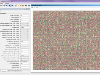
Physical Activity Lifelong Modelling & Simulation (PALMS) model
The Physical Activity Lifelong Modelling & Simulation (PALMS) model is an agent-based micro-simulation that predicts the lifelong physical activity behaviour of individuals of a population and its effect on their quality of life.
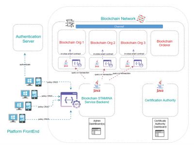
Information Protection and Secure Data Sharing Blockchain Tool
An access control policy management framework implemented by capitalizing on the Blockchain technology

Flee - Predictive Modelling Tool
Flee is an agent-based modelling code used to model (forced) migration and other movements across country borders.

SARS-Cov-2 and Escherichia coli (E. coli) ESBL detection with SHERLOCK/DETECTR
Rapid detection of SARS-Cov-2 and E. coli (ESBL) via the utilisation of a portable SHERLOCK/DETECTR approach.
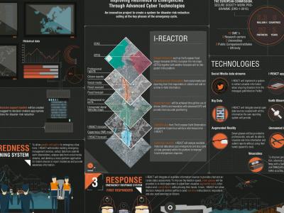
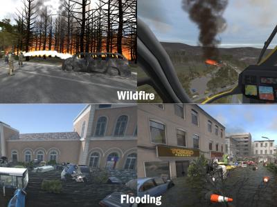
I-REACT
Due to climate change, floods, wildfires and other extreme weather events are becoming more frequent and intense. This scenario poses a challenge for current risk management systems.
EPISECC Inventory
The EPISECC Inventory is designed for the analysis of the management of selected past disasters with specific focus on interoperability and efficiency
 |
Portfolio of Solutions web site has been initially developed in the scope of DRIVER+ project. Today, the service is managed by AIT Austrian Institute of Technology GmbH., for the benefit of the European Management. PoS is endorsed and supported by the Disaster Competence Network Austria (DCNA) as well as by the STAMINA and TeamAware H2020 projects. |