Contact
Provider(s):
Knowledge sharing plays a central role specifically during , allowing the access to and the availability of critical information regarding risks and disasters. Lack of information complicates the efficient management of catastrophes and weakens the decision-making processes. For these reasons, it is fundamental to develop an infrastructure able to manage knowledge and, most specifically, to increase economic and social values fostering knowledge creation and sharing, to use to perform better, to be updated and to enhance sustainability. Communication and decision-making during must occur in a compressed timeline since faster than usual is needed to stabilise a dangerous situation, prevent further losses, and begin reconstruction. In such complex situations, a collaborative and dynamic environment allows the actors to interact with each other and join their efforts so as to collectively cooperate. Such a kind of environment needs supporting tools allowing a timely situational picture generation and sharing with the aim to facilitate the communication and collaboration among users, as well as to improve the efficiency and effectiveness of decision-making. In the context of the H2020 STORM (700191) research project was designed and implemented a Collaborative and Decision-Making Dashboard where, at any moment, the end users can have an up to date situational picture to better act either in the phase to mitigate the effect of climate phenomena or in the intervention phase when a occurs. The proposed tools vectored through leading-edge technologies are expected to enhance collaboration, co-ordination and to support decision-making amongst stakeholders. In the STORM Collaborative Decision-Making platform, collaborative and operational environments are strongly interconnected each other. Existing knowledge (e.g. , guidelines, , procedures and processes, etc.) related to natural disaster risks and impacts can help teams of experts in making decisions and sharing new knowledge (e.g. from the situational picture, and data analytics) for a prompt and more effective . The platform aims to be the enabler (and at the same time supportive) for the development of a collaborative environment. A customizable dashboard, mapping the current situation in a synthetic way and gathering the most relevant information, is a key asset for supporting an efficient and effective decision making. As a main benefit, the involved actors will be aware about the formulation and selection of reduction measures based on available risk information and stakeholders’ needs, speeding up time where the right people with the relevant skills and disaster events are identified in a more timely manner. STORM Collaborative Decision-Making platform provides a set of specific collaborative and operative services coming from the two interconnected environments. Specifically, the collaborative services are on the top of the dashboard, namely Network & Site, Process Mining, Update News and Document Library, along with the User Profile and the Semantic Search. The operative services are on the left side, namely Sensory Map, Visual Analytics, Event Manager, Risk and Situation Awareness.
Collaborative services
A set of collaborative services is provided in order to enable the Cultural Heritage and stakeholders to collect, contribute and share data and information as well as the knowledge on the potential threats, vulnerabilities, risks, along with the actions to be performed to manage, in a suitable way, the critical situation when it occurs, putting in the loop both their own experience and skills. The available data and information related to the disaster (i.e. threats, vulnerability and risks) and how have to be managed, are collected, managed and shared among different community of stakeholders (e.g. emergency operators, first responders, citizens, public authorities, etc.).
- User Profile. Every user registered on the platform has its own profile and access to a set of specific sites he belongs to and the roles assigned. User profile gives each user a complete visibility into how other users manage knowledge and their activities. Moreover, it shows user’s relevant roles and responsibilities, so each user knows who is responsible for each relevant area, procedure and task.
- Semantic Search. The Semantic Search service is a functionality featured as an intelligent information retrieval. This approach tries to understand the intent and the context around a query in order to retrieve the most pertinent resources, related to the particular information request. It delivers the user a better match to queried content and information.
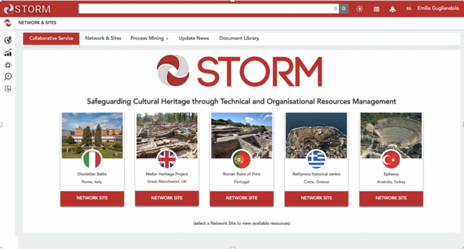
- Network & Sites. The Network & Sites is a way to organise activities among all the members belonging to the same site. In this way, it is possible to avoid sharing of data, activities with unwanted receivers.
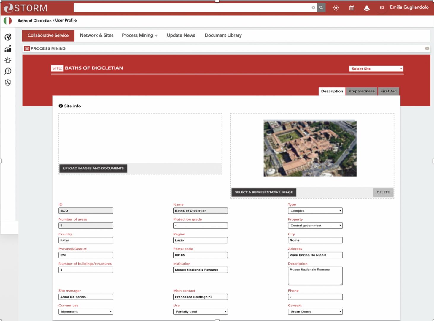
- Process Mining. The Process Mining supports site managers and Cultural Heritage professionals during the STORM Quick Assessment process, covering both the phases of feeding and using the system, before and after an hazard. The STORM Quick Assessment process consists of the following procedural phases: Data Collection, , Response and Debriefing.
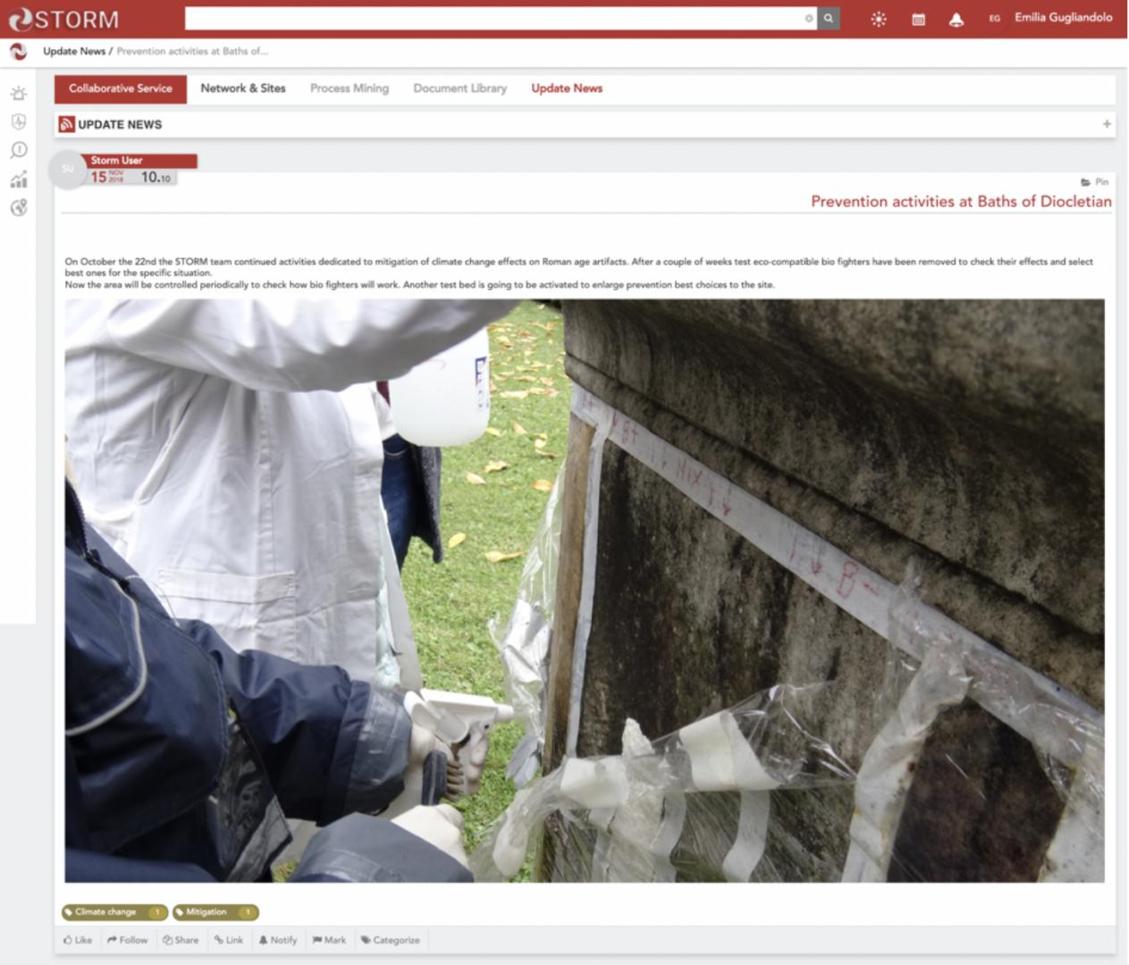
- Update News. This service allows users to share particular news. In this way, tacit knowledge on strategic issues arises. The service allows community users to add blogs, categorise and associate them to other contents on the platform.
- Document Library. The Document Library is a service that supports document management (upload, view and download documents) among users. Each user can organise documents by grouping them into specific folders so that everyone can easily consult them. The service allows users to add a new folder in order to upload one or more documents at one time.
Operative services
A set of operative tools, services and application for a collaborative decision making to assist in making decisions by providing additional supportive tools and services to enhance understanding and management of a critical situation in a collaborative and shared manner. A set of operative tools, services and applications helps to generate the current situation to be analysed giving all the necessary information to identify decisions that need to be made; recognise the right processes/tasks to be selected and people (and their specific role) to be involved for each of them; evaluate the measurements and options to make better decisions; collaborate with other involved stakeholders; gathering the most relevant information in order to detect anomalous events; evaluate the decision taken. Moreover, to enable an effective decision making process, users need a complete overview of the critical situation that means, in terms of data and information, an integration of current (real-time) and past knowledge of critical evolution to help decision making leading actors to better understand the situation in progress.
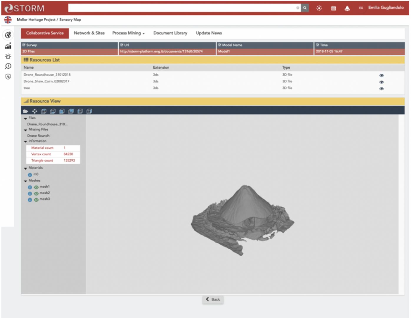
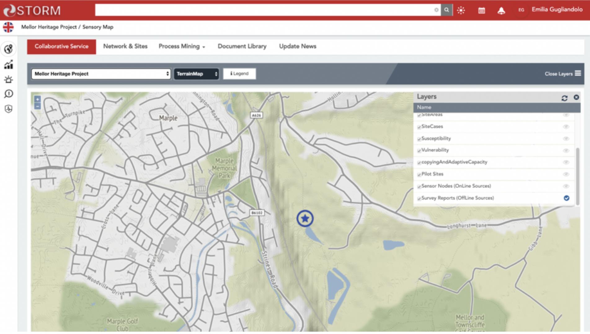
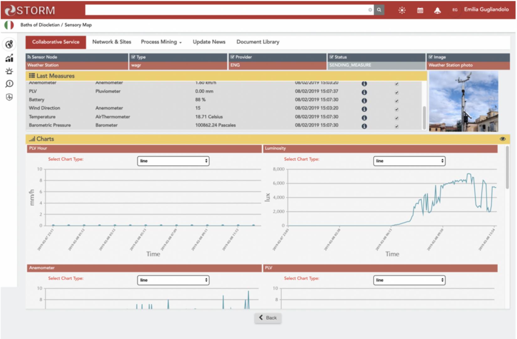
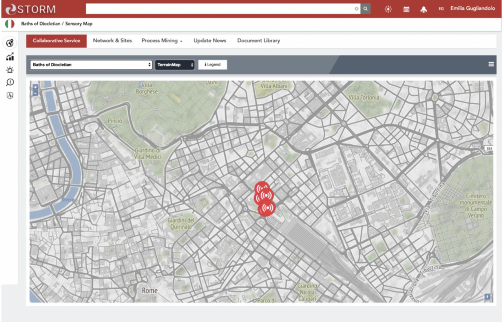
- Sensory Map. The Sensory Map service shows the monitoring areas and the position of the installed sensors. It consists of a 2D map where the icons depict the position of the installed online sensors and the results coming from the offline sensors with regard to the main areas to be monitored due to they have been affected by main hazards.
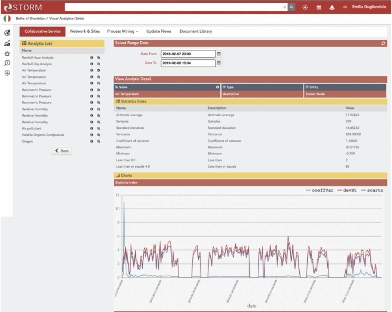
- Visual Analytics. The Visual Analytics service gathers (online) sensor network data and other relevant information from the disaster-affected areas and presents the result their analysis to the user in an effective graphical way. In that view, data are processed to provide easy-to-understand representations considering both past events and the current situation at sites.
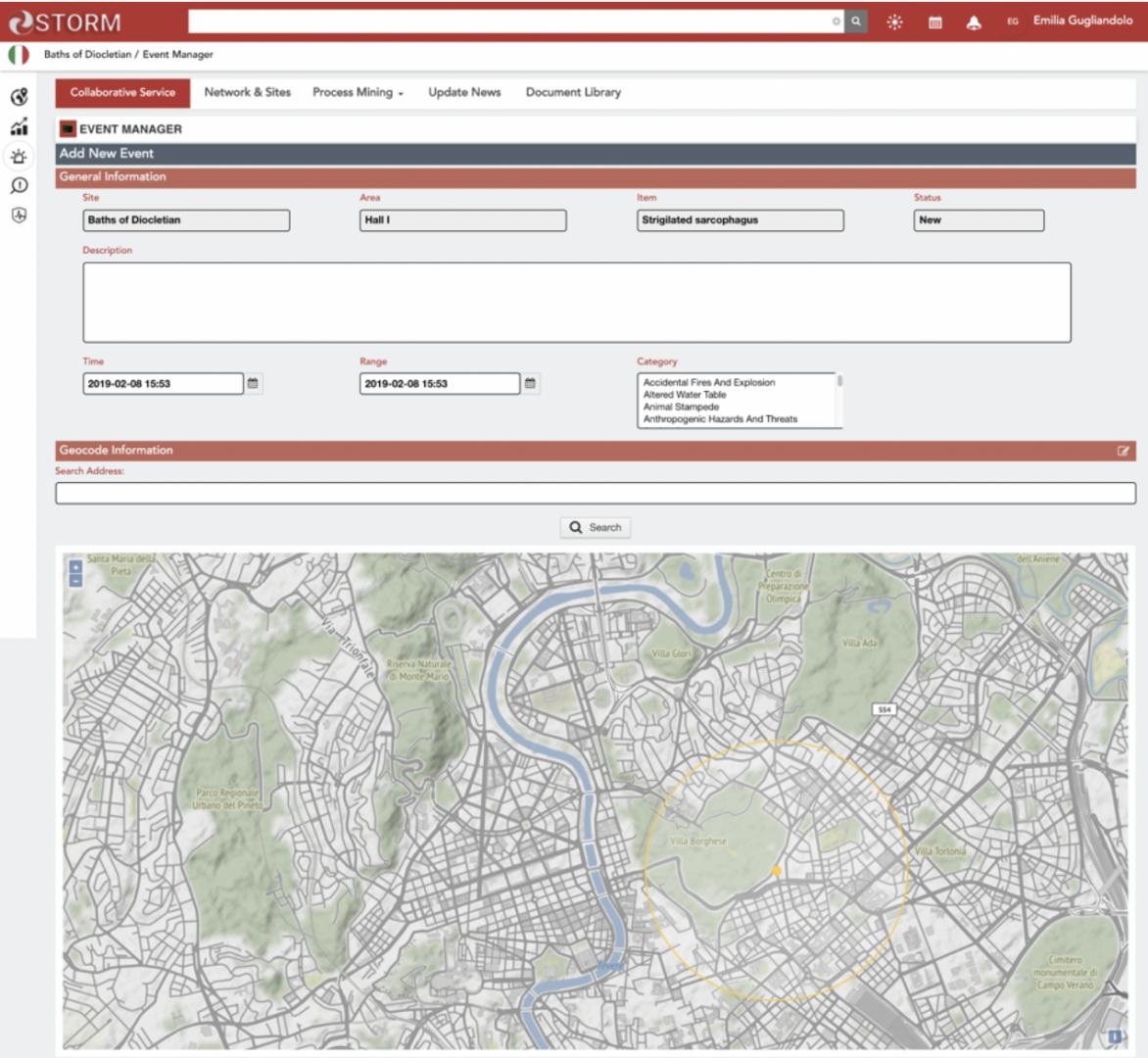
- Diagnosis Reporting. The Diagnosis Reporting enables the detection of hazardous events or identifies relevant threats starting from the useful information extracted by processing and analysing data from online and offline sensors. The detection of a damage caused by a hazardous event previously occurred or the identification of some threats that could increase the exposition or vulnerability of an asset against specific hazards can be notified to the platform.
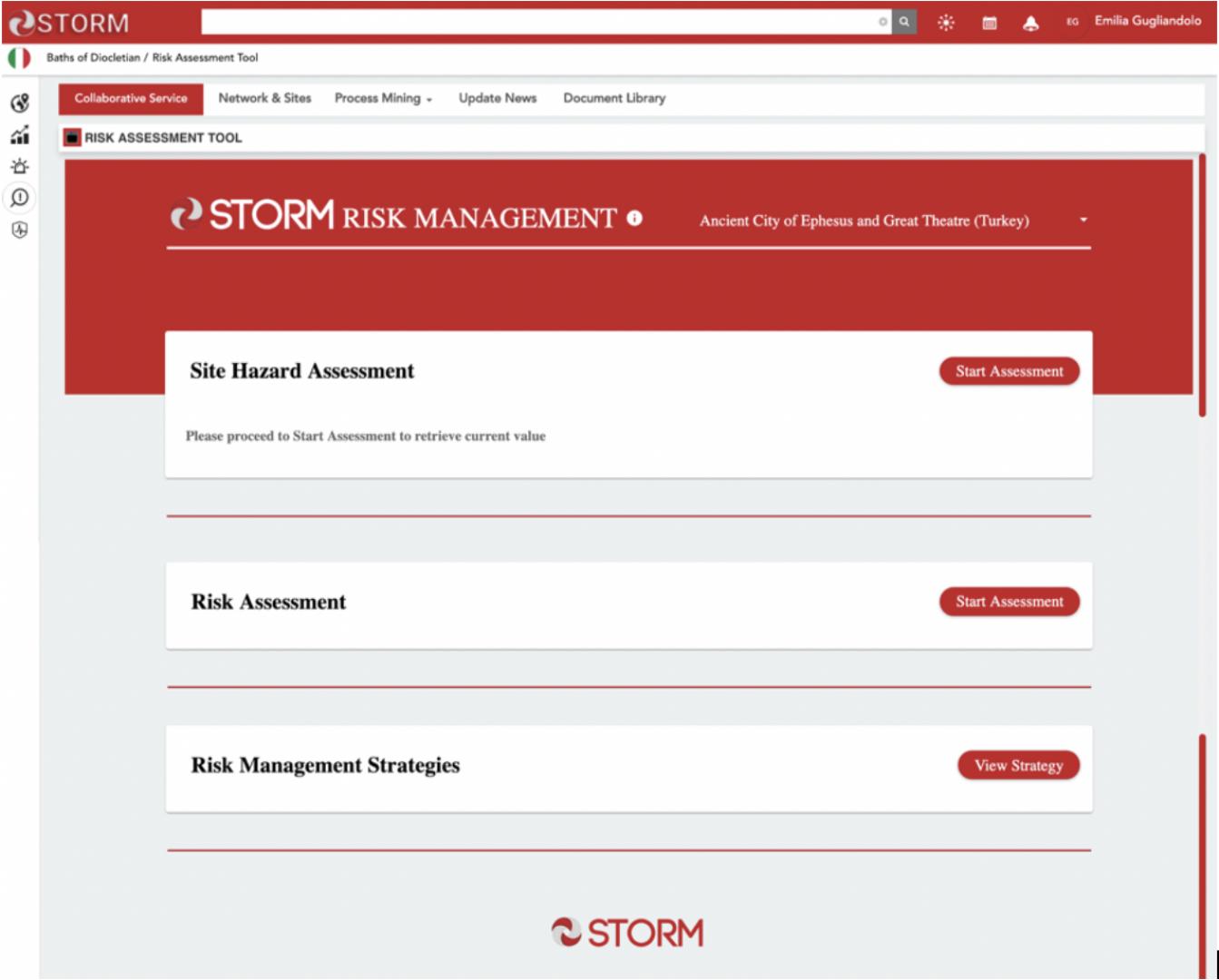
- Risk Assessment and Management tool. Risk Assessment and Management tool supports the derivation of appropriate risk management strategies developed in the context of STORM. The tool aims to help the site managers and experts to assess the level of risk in different areas of the site and determine site-specific strategies to mitigate the risk associated with natural hazards and climate change.
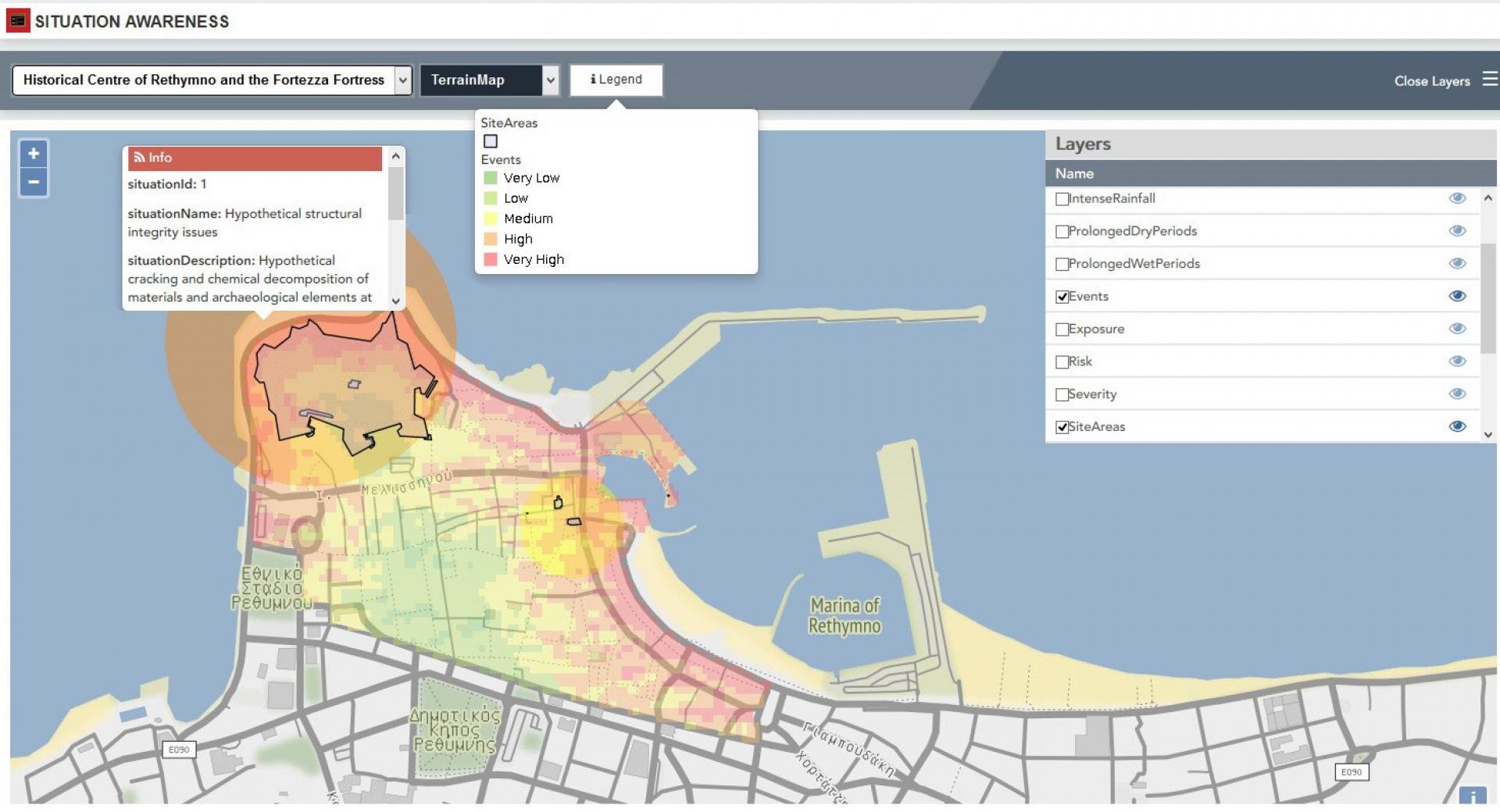
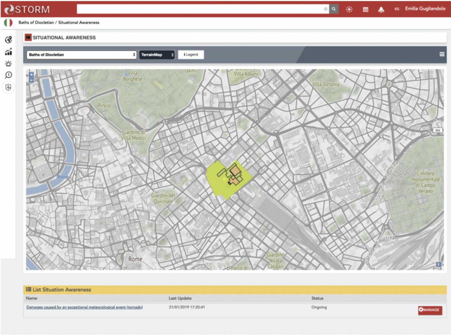
- Situation Awareness service. Situation Awareness services provides a detailed view of maps with all the indicators and parameters essential to take under control the situation and assist decision makers. A clear picture of the situation with all the details about vulnerability and risk areas, hazardous events, and other relevant information are visualised in a thematic map in order to identify the impact on a cultural heritage site, its areas and assets. In this way, users can understand the current situation status, having a real-time monitoring on how the situation evolves and enabling a kind of common operational picture.
STORM Collaborative and Decision Making Dashboard has introduced a comprehensive approach that supports end users with transversal services as data analytics and knowledge sharing during all these phases. The main features and consequent benefits of the STORM Dashboard are the creation of an interactive environment that would not only provide opportunities for an exchange of information among users of the system but could also facilitate the establishment of closer links. A speeding up of the response times where the right people with the relevant skills are identified more quickly and disaster events dealt with in a faster manner. Finally, a more effective collaboration between the different actors by interactively involving them in the decision making process has been established.
Supported Use Cases
STORM Use Cases


 |
Portfolio of Solutions web site has been initially developed in the scope of DRIVER+ project. Today, the service is managed by AIT Austrian Institute of Technology GmbH., for the benefit of the European Management. PoS is endorsed and supported by the Disaster Competence Network Austria (DCNA) as well as by the STAMINA and TeamAware H2020 projects. |