Contact
Provider(s):
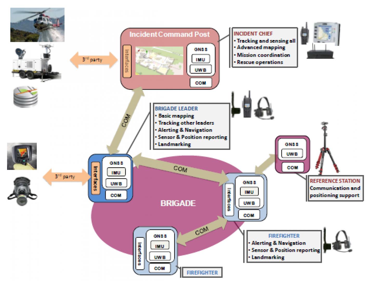
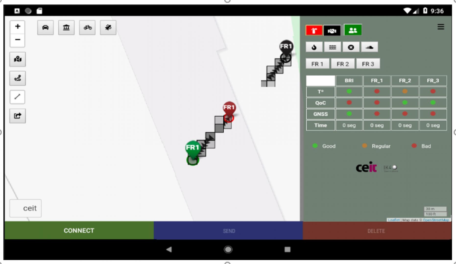
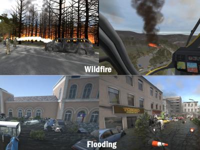
With the AIOSAT system, the team commander of first responders will handle the information required for the success of the operation and to avoid any fatalities. It consists of two main elements:
Portable system (First Responder): equipped with the AIOSAT advanced positioning system and AIOSAT communication system. The functions of this portable system will be:
- Continuously transmit the position of the first responders. It allows data communication of the team commander with the firefighters and the Mobile Coordination Centre (MCC) to exchange commands and alerts related to generic mission operations and in particular to prevent rescue workers from entering dangerous locations.
- Firefighters only receive the different alerts having not any interaction with the system, brigades and MCC will take advantage of the added value information that AIOSAT provides ensuring also the safety of their dependents.
- Receive required information from the Mobile Coordination Centre (MCC) for positioning augmentation enhancing accuracy and integrity monitoring techniques, such as different Receiver Autonomous Integrity Monitoring (RAIM) for safety related applications.
Mobile Coordination Centre – MCC: the mobile unit (in a truck for example) will be equipped with the AIOSAT positioning system, AIOSAT communication system and AIOSAT TA system. The functions of this mobile coordination centre will be:
- Continuously receive the position of the First Responder cluster and track the rescue workers.
- Setup a system to retrieve realtime differential GNSS corrections. The proposed alternative is the use of EGNOS, however to increase the availability of the corrections in harsh environments where EGNOS is not available,
- Transmit the differential GNSS corrections and integrity over the AIOSAT communication system.
- Transmit required orders to prevent rescue workers from entering irreversible risky locations (alarms).
- Interface with existing on-board systems and external networks (via SATCOM) to access relevant information needed for the mission, e.g. outdoor and indoor maps.
- Overall management and monitoring of the AIOSAT network and devices.
Supported Use Cases
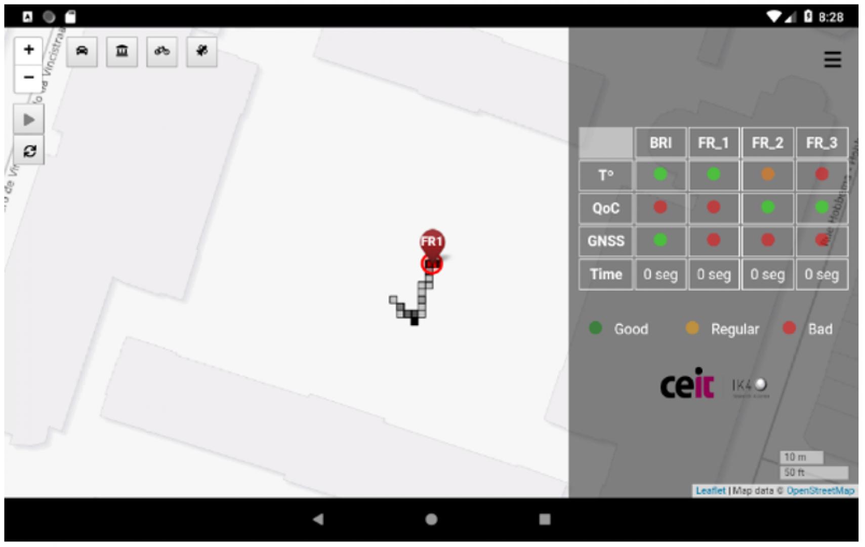
AIOSAT UC1: tracking the team members
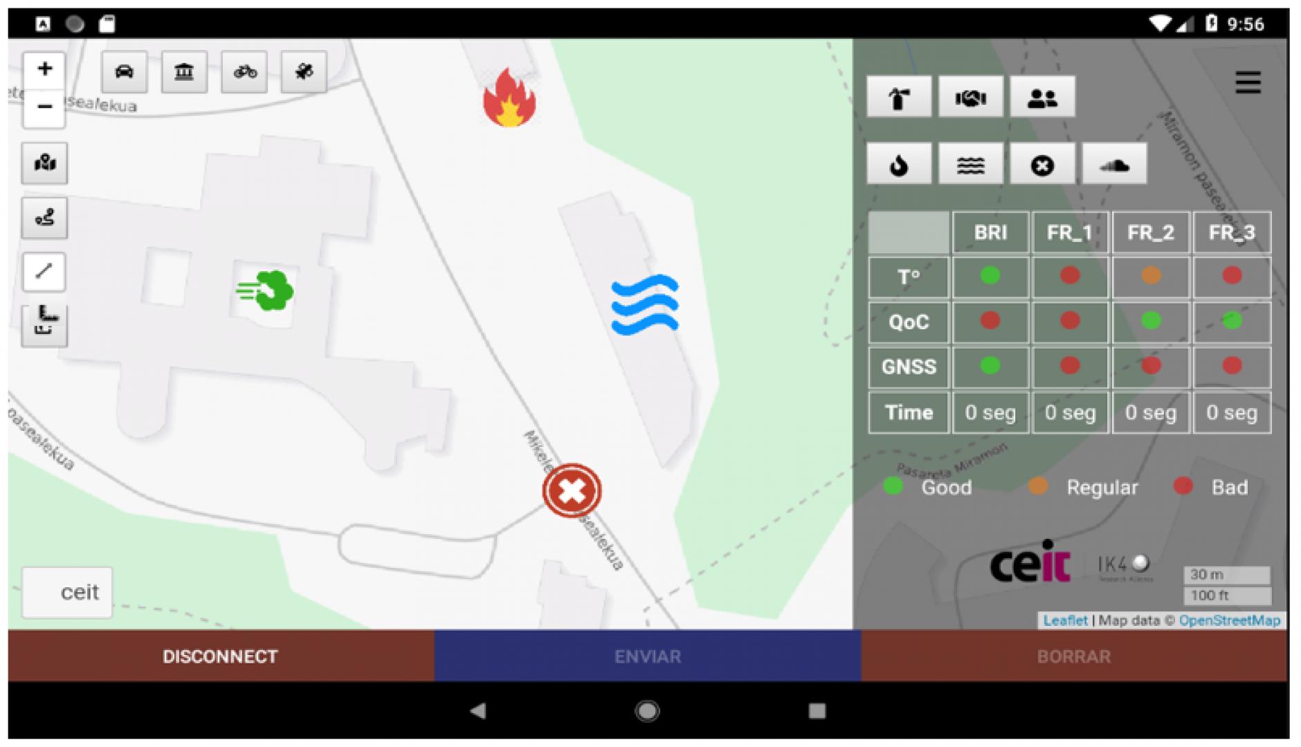
AIOSAT UC2: Send commands and alerts to field workers
AIOSAT UC3
References
AIOSAT
AIOSAT is an on-going research project which received funding from the European GNSS Agency under the European Union’s Horizon 2020 research and programme under grant agreement No 776425.
We are at the mid term period of the project and collecyting data with the first prorotype of the system and the track and alarm application.
You can follow our progresses on the web page, twitter (@AIOSAT_eu) and LinkedIN
Documentation
Similar Solutions


 |
Portfolio of Solutions web site has been initially developed in the scope of DRIVER+ project. Today, the service is managed by AIT Austrian Institute of Technology GmbH., for the benefit of the European Management. PoS is endorsed and supported by the Disaster Competence Network Austria (DCNA) as well as by the STAMINA and TeamAware H2020 projects. |