Contact
Provider(s):
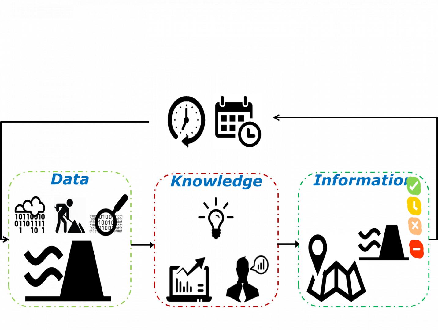
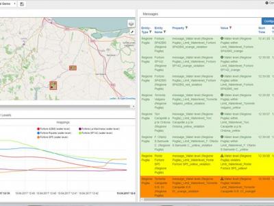
In the Real Time Flood viewer information is presented for the actual situation (using measurements) and upcoming day’s using forecasts. Information is clustered into:
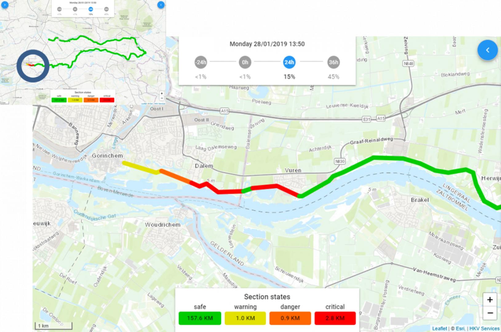
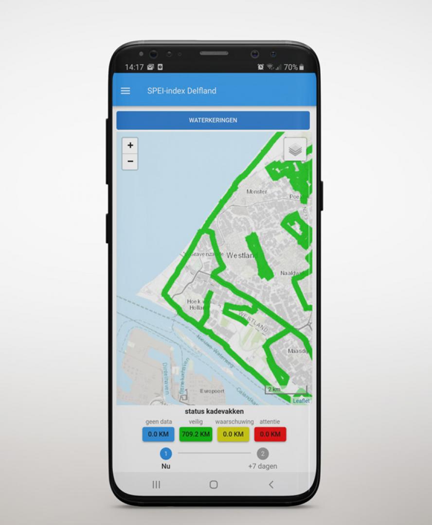
- Water levels: Measured and forecasted water levels at different locations, and the translation of these water levels to the hydraulic load (including wind and waves) to a levee or dam at a certain location.
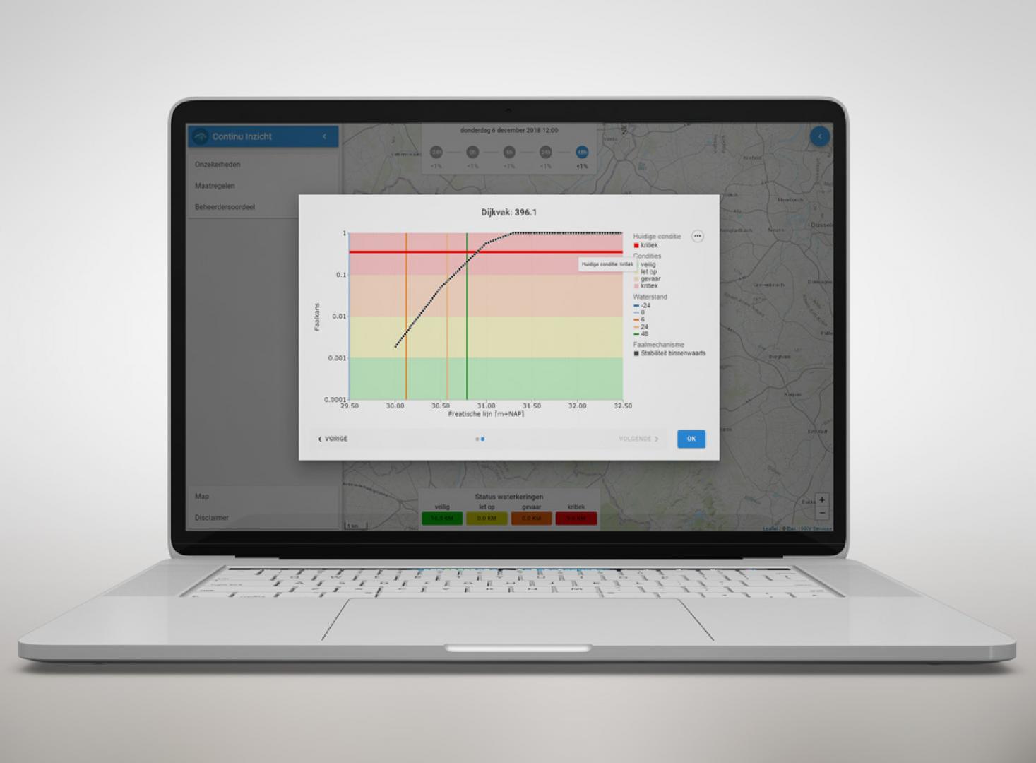
- Levees: A levee can be divided in different sections based on common characteristics. For each levee section the characteristics are described that determine the strength of the levee.
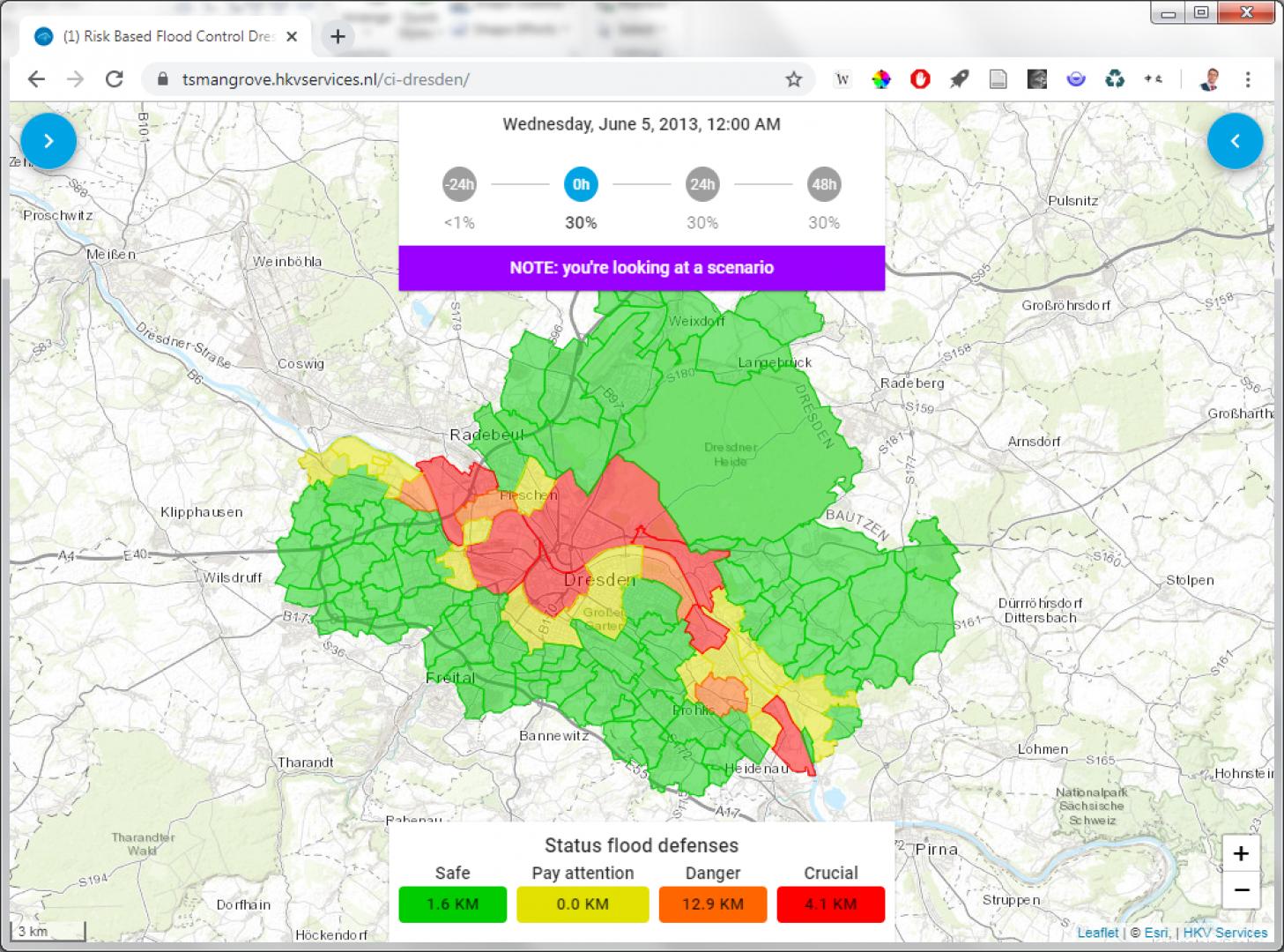
- Zones: the conditional risk in an area is quantified using flood scenarios and the probability of failure. An area can be divided in different zones for example based on zip code. The conditional risk is quantified in a conditional risk of economic damage, conditional risk of people at risk and conditional fatalities and local probability of exposure to a flood. In Figure 4 we show an example of the conditional risk per zip code.
- Measures: For each levee or dam also a library of different fragility curves, which describe the effectiveness of measures, can be prepared in advance. For example the height of the levee can be corrected, as the states of the grass revetment etc.
- Human (expert judgment): The probability of failure, as the consequences of flooding, can be corrected for biases by human assessments. Therefore measurements can be used, field inspections as well as remote sensing and data science techniques.
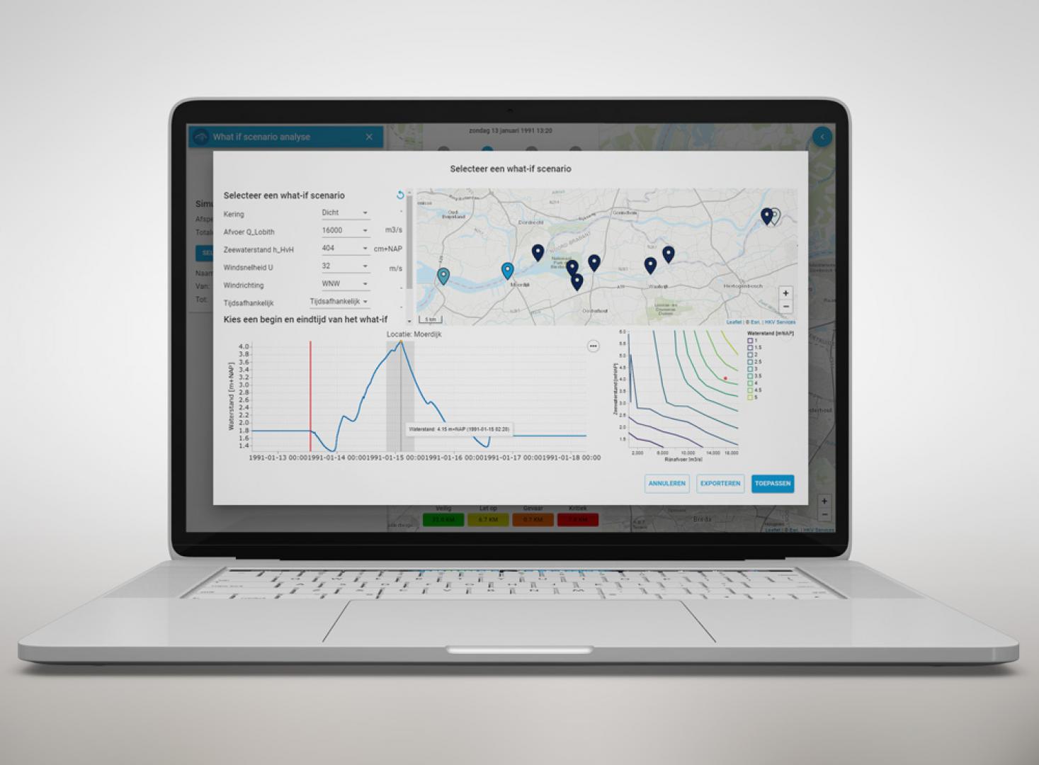
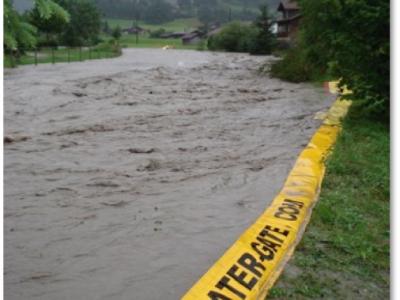
All available information has been gathered in a Real Time Flood Risk Assessment viewer, to be used to determine the chances of dike failure and connected risks (impact). For purposes of learning, validation and asset management also synthetic ‘what if’ events (water levels) can be defined. These synthetic events can describe potential or historic flood events.
The Real Time Flood Risk Assessment viewer is useful to facilitate the discussion on possible measures. It helps the experts to explicit their opinion and it provides insight in a complex system with interdependencies. Knowledge could be available in their heads and in this way, while presenting and discussing the options with the help of the map, it is also visible for the other experts in the expert team how this knowledge could benefit in the situation.
Supported Use Cases
Flood Risk Expert judgment Budapest (Hungary)

Crisis Management Improvements Waterboard Rijn and IJssel (NL)


Levee safety assessment Waterboard Hollands Noorderkwartier (NL)


Dike strength: Functional and technical design (NL)


References
Task Group Floods report
In the Task Group Floods, we have elaborated a method called Real Time Flood (RTFRA), included in which is an expert judgement process which can be used reproducibly, and which in practice estimates the impact of a measure, on the basis of the expert judgement. The RTFRA method thereby improves the quantification of flood reduction and support personnel and decision-makers.
The aim of the task group was to develop an internationally-recognised approach to measure the effectiveness of flood measures, and bring about an effective and efficient use of open data (such as water levels, levee information, flood scenarios, alarm levels, critical moments, possible risk reduction measures per zone or area).
Paper Conditional flood risk management
The modern water manager not only looks at the protection against flooding but
also at possible consequences when protection fails and how the risks and consequences can be
reduced. In a risk approach (as adopted in 2017 in The Netherlands) the acceptable probability
of failure per year of levees is determined based on the acceptable risk (risk = probability x consequence).
During operational flood risk control the failure probability per year is not key information,
but measurements and forecasts describe the conditional risk. The method 'continuous
insight' focuses on daily risk based floodcontrol. The knowledge and information for low
frequent assessing and designing of levees, is made continuous available given forecasts of the
next days, we speak of the conditional floodrisk. Choices in day-to-day work processes such as
inspection, maintenance, operational management can be optimized based on the conditional
risk. The same applies for flood fighting, warning and evacuation. All processes are fed from a
single point of truth of information (which is dynamic). The water manager is in control and reduces
the risk effective. In this article we outline the experiences with this method for a case in
the Netherlands, the role of fragility curves and human
.
Documentation
Similar Solutions
 |
Portfolio of Solutions web site has been initially developed in the scope of DRIVER+ project. Today, the service is managed by AIT Austrian Institute of Technology GmbH., for the benefit of the European Management. PoS is endorsed and supported by the Disaster Competence Network Austria (DCNA) as well as by the STAMINA and TeamAware H2020 projects. |