As an alternative to searching directly for solutions, you can also search for CM gaps and find out which solutions address the gaps you are interested in.
PDF export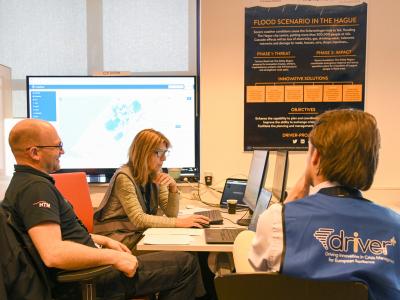
CrisisSuite
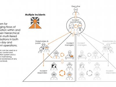
The main objective of CrisisSuite (online crisis management software) is to enable organisations to successfully manage information during a crisis.
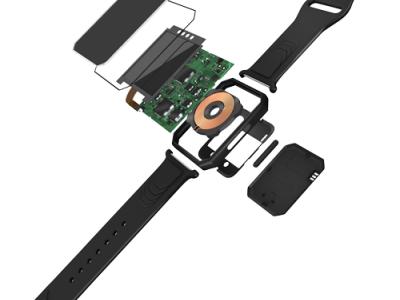
SmarKo Wearable Monitoring Tool
SmarKo, a smart wearble sensor device, that enables remote real time monitoring of health, environmental and physical activity data as well as geolocation and can transmit the measurement data to a mobile app.
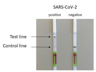
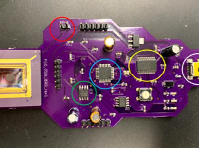
SARS-Cov-2 and Escherichia coli (E. coli) ESBL detection with SHERLOCK/DETECTR
Rapid detection of SARS-Cov-2 and E. coli (ESBL) via the utilisation of a portable SHERLOCK/DETECTR approach.
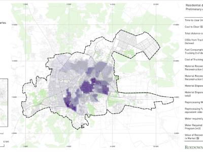
Debris Tool
The Debris Tool is a software based solution designed to amalgamate various defined inputs from the field, historic survey data and other sources, for the prediction and modelling of waste and debris removal options in a post-crisis environment.
Influenza A (H1N1) on-site detection (POCT)
On-site detection of Influenza A (H1N1) with a portable qPCR device (POC)

Real-time detection of Measles, West Nile Virus and SARS-Cov-2
Genetic markers allowing real time point-of-service detection of Measles, West Nile Virus and SARS-Cov-2 via the utilization of a portable qcLAMP device
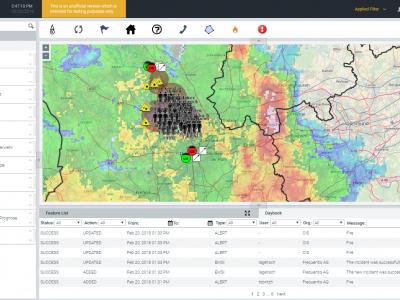
LifeX COP
LifeX COP is a web-centric multi-user Solution developed by Frequentis to address the lack of a Common Operational Picture in the field of Crisis Management.
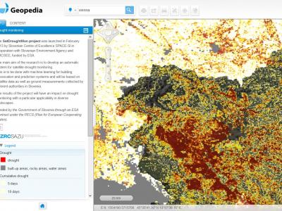
Drought Monitoring Portal
Automatic system for satellite drought monitoring

Satellite imagery archive within GIS in the Cloud
Access to processed and analysis-ready Sentinel (Earth Observation) imagery
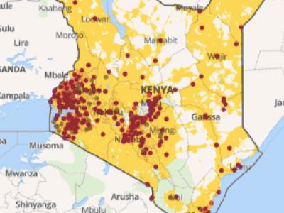
Planwise
Identify where help is needed most - transparent, data-driven analysis for decision makers
Geochat
Lets team members interact to maintain shared geospatial awareness of who is doing what where — over any device, on any platform, over any network.

Rapid Mapping
DroneRapidMapping enables rapid mapping of incident/crisis area. The solution enables very fast generation of orthophoto maps based on imagery acquired by any drone (RPAS) available to rescue or crisis management actors.
CITY MANAGEMENT PORTAL
The city management portal is specially designed for routine management of city operations as well as large-scale events and crisis situations.
zirkarta
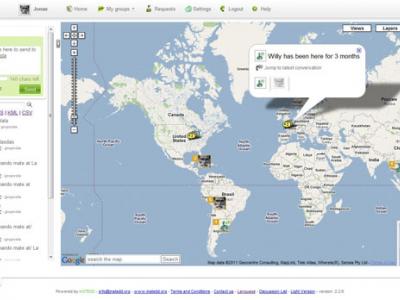
Zirkarta gets the right information to the right people at the right time to enable geographically dispersed people to work together to achieve a common objective during a crisis.
SecuRescue
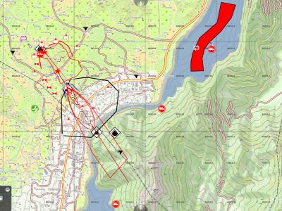
Local situation awareness in real time for security forces in disaster and crisis missions.
 |
Portfolio of Solutions web site has been initially developed in the scope of DRIVER+ project. Today, the service is managed by AIT Austrian Institute of Technology GmbH., for the benefit of the European Management. PoS is endorsed and supported by the Disaster Competence Network Austria (DCNA) as well as by the STAMINA and TeamAware H2020 projects. |