Contact
Provider(s):
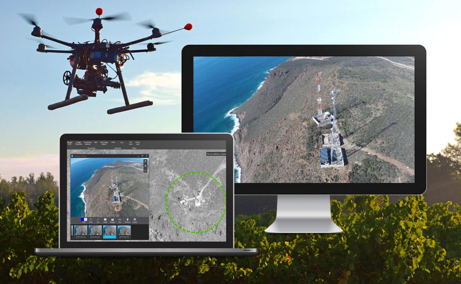
The resulting maps can be viewed and analysed in the dedicated geoportal or any GIS environment already utilised by management institutions. The additional product is a 3D terrain model, enabling better and more intuitive understanding of the area of interest.
Rapid generation of maps is enabled by cloud computing. A drone is expected to conduct a flight over area of interest and acquire imagery (using standard on-board camera) in line with the standard operational procedures. Data is uploaded into cloud and automatically processed. The resulting orthophoto map is available within the dedicated geoportal that can also provide access to other maps (satellite, topographic, etc.). The 3D model can be viewed in any standard program (3D viewer).
The efficiency of rapid mapping requires the Internet access with sufficient throughput. Validated efficiency: mapping of 10ha with 2cm pixel and LTE Internet access requires 26 minutes. This timing covers all activities: mission request (crisis manager's briefing for a drone ), flight preparation, conduct of the flight, landing, data retrieval and upload, all calculations, preparation of geoportal content.
Generation of the high-quality 3D model requires additional 20+ minutes.
The DroneRapidMapping as a whole integrated represents TRL 7 maturity level and the 3rd Stage of (Initial Piloting). While it has not yet been implemented fully operationally, its high maturity results from the approach integrating already operational (TRL 9) building blocks. Imagery is acquired by commercially available drones and transmitted to the Internet using existing GSM or SatCom solutions. Orthophoto maps calculations are conducted by Hexagon software components using the innovative operational IT cloud infrastructure (EO Cloud). Results are delivered by operational geoportal software.
Currently the solution does not have a dedicated user interface for data upload and configuration of calculation parameters - these actions are conducted by experts supporting use of the system.
Input for orthophoto map:
Series of raw photographs, made perpendicularly (camera angle=90’) to the ground with overlap of 60/70 (forward / lateral overlap [%]), suggested flight height depends on the resolution of camera sensor and expected pixel size. For 4k camera and 2cm pixel we recommend 50-75m flight height, for forest and water surface - not less than 150m.
Series of raw photographs, 90’, 80/80 overlap, preferable with fish-eye lenses – for high quality 3D model.
Output for orthophoto map:
2D georeferenced map as a geotiff file to download.
2D georeferenced map as WMS link (or displayed on solutions owner portal for public access).
3D files in .obj format to be downloaded
Supported Use Cases
Crisis area mapping and 3D model creation
 |
Portfolio of Solutions web site has been initially developed in the scope of DRIVER+ project. Today, the service is managed by AIT Austrian Institute of Technology GmbH., for the benefit of the European Management. PoS is endorsed and supported by the Disaster Competence Network Austria (DCNA) as well as by the STAMINA and TeamAware H2020 projects. |