Provider(s):

You must log in in order to see contact information. If you don't have an account, you can ask for one on this form.
Local situation awareness in real time for security forces in disaster and crisis missions.

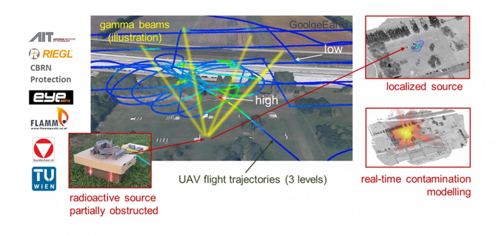
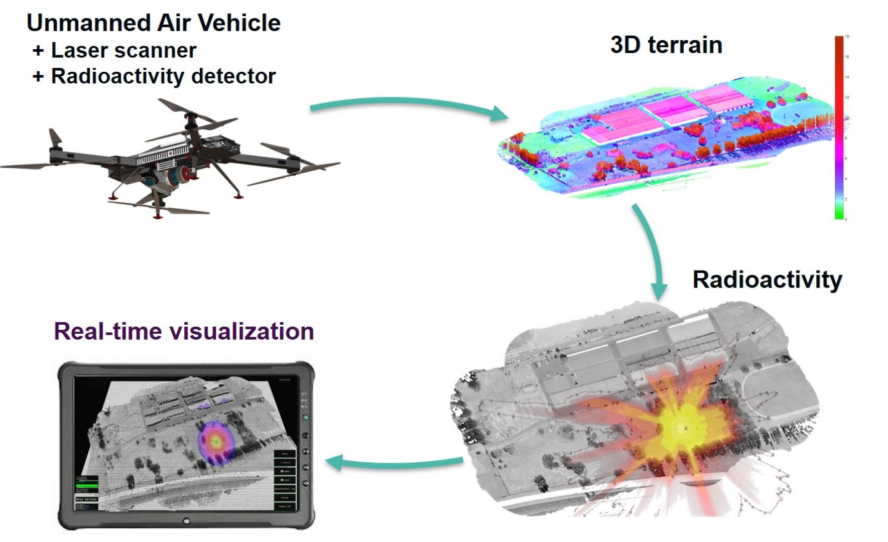
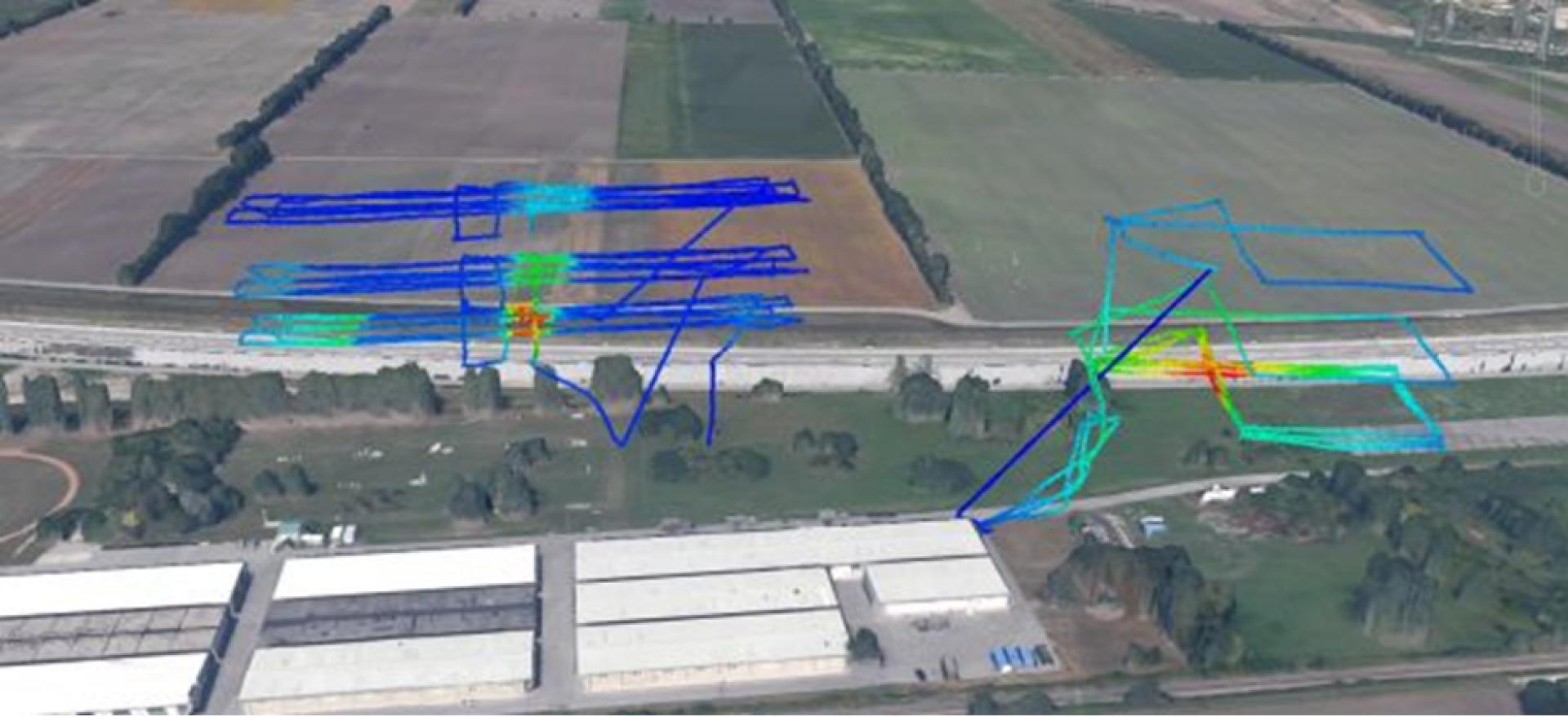
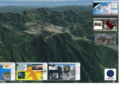
The focus of the SECURESCUE project is the real-time 3D 360° mapping of an area for using mobile exploration robots. The goal is to achieve fast situation and awareness to support the safe and efficient deployment of first responders. The novel airborne laser scanner is mounted on an unmanned aerial vehicle (UAV) is used to improve situation awareness for scenarios.

The data is combined with existing information from on-board sensors (e.g. gas and radiation detectors) for the exploration of disaster areas and detection of possible risks (e.g. high contamination levels, dangerous gas) for safe search and rescue activities. The project developed the real-time representation of the 3D information (e.g. visual, radiation, chemical, position) and continuous visualization in the form of a 3D information map on mobile terminals (e.g. handheld devices) for responders. The whole system has been evaluated using real scenarios from the Defence Ministry (BMLVS) in Upper Austria.

Outdoor – UAV-based (unmanned aerial vehicle) real-world test: 

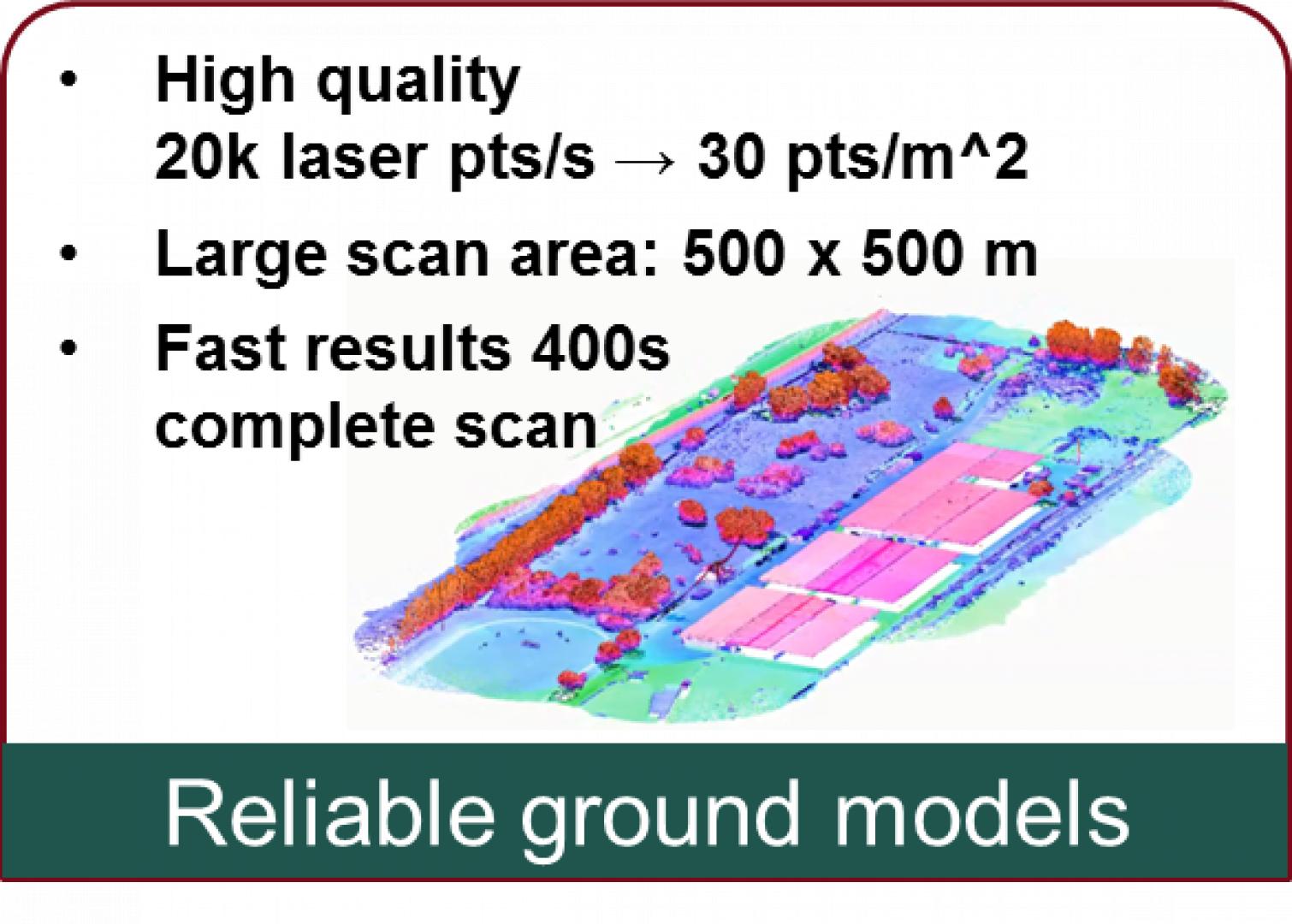
Generate a consistent view of 3D LiDAR and CBRNE sensors by

  • fusing all available measurements (LiDAR, radioactivity) into a
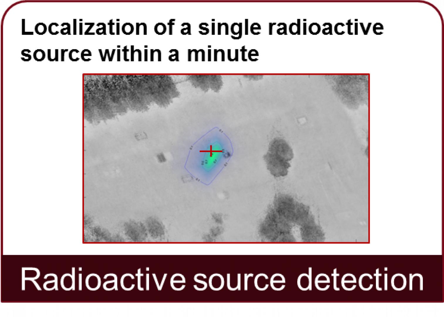
  • comprehensive information set to reveal the location and parameters of radioactive sources, and
  • real-time modelling of radioactive contamination
Supported Use Cases

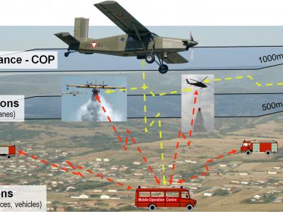
SecuRescue: Real-time situation survey of the local situation for emergency response forces with unknown / dangerous hazardous substances

In and operations, as well as in operations involving unknown hazardous substances, forces are often exposed to great and unpredictable dangers and risks, as there are only a few reliable information regarding the current situation with regard to deployment planning.  For planning-relevant information, for example, the location and status of sources of danger or accessibility are considered. In advance, digital or paper-based information - e.g. Plans or reference works - often already available in many crisis situations. But these have the big disadvantage that they are not based on the current conditions on site. Forces often face unpredictable and therefore unexpected risks in the required reconnaissance. There are individual and different solutions for the detection of hazardous substances on the part of sensors as well as of robotics. However, there is currently no system worldwide which quickly provides a situation image (visually in 3D) in real time for the personnel. This closes the project SecuRescue.

SecuRescue therefore aims to improve the basis for decision-making by means of technological support, and in particular by means of ongoing rexploration results, for resource planning. As an integral part, 3D terrain data from a high-quality laser scanner and data from sensors, such as images of a novel 3D 360 ° panoramic camera or sensor data on hazardous substances, merged. The airborne laser scanner system, optionally extended by a (thermal imaging) camera, is used from an unmanned aerial vehicle. For potential hazards, such as Fire, leakage of hazardous materials or radioactivity, the unmanned aerial vehicle, explores the terrain to allow real-time creation of an interactive map (COP). The determined measured values of the sensors (for example: gas and pollutant concentrations, gamma radiation, etc.) are displayed in this map as hotspots. This virtual map gives the dispatcher an overview of the area of risk. Through this information, the chief of operations or the specialists of the respective field of expertise can make a better of the situation before emergency services enter the danger zone. As a result of the project, the emergency forces are provided via tablet-PC with interctive maps with different levels of content (eg maps, building floors, levels including the existing pollutants such as: gases, radioactivity, ...), which facilitate the deployment planning. So it is possible to explore operations in a potentially life-threatening environment without putting their personnel at risk.

Related CM functions

Overview picture
Illustrations
Project overview: local situation awareness in real time for security forces in disaster and crisis missions.
Graphical representation of the project content, affected systems and interfaces.
3D terrain map: Reliable ground models
Radioactive source detection: Localization of a single radioactive source within a minute
UAV trajectory coloured by radiation intensity
  • 0
  • 1
  • 2
  • 3
  • 4
Video illustrations
eu Portfolio of Solutions web site has been initially developed in the scope of DRIVER+ project. Today, the service is managed by AIT Austrian Institute of Technology GmbH., for the benefit of the European Management. PoS is endorsed and supported by the Disaster Competence Network Austria (DCNA) as well as by the STAMINA and TeamAware H2020 projects.