As an alternative to searching directly for solutions, you can also search for CM gaps and find out which solutions address the gaps you are interested in.
PDF export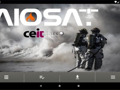
AIOSAT
The AIOSAT (Autonomous Indoor / Outdoor Safety Tracking System) system will allow the team/brigade commander to track the location, including a confidence margin on the location, answering a necessity of the emergency services.
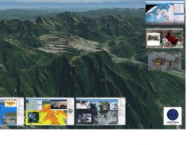
vieWTerra Evolution
vieWTerra Suite is a suite of products allowing responders to rapidly build a virtual 4D representation (3D synthetic environment+ Time dimension) of any potential Crisis area on Earth.

Evacuation & Repatriation Management Platform
Evacuation and Repatriation Management Platform (EMP)
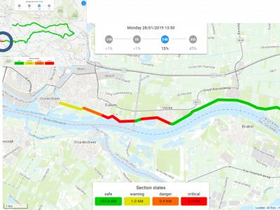
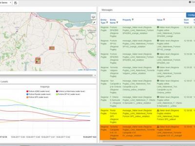
Real Time Flood Risk Assessment Viewer
In the Real Time Flood Risk Assessment viewer risk information is presented for the actual situation (using measurements) and upcoming day’s using forecasts, uses a single point of truth of information for all the daily operational working processes.
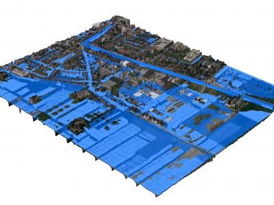
3Di - Water Management
3Di is a cloud-based versatile water management instrument that enables flood forecasting and risk mapping.
SOCRATES OC
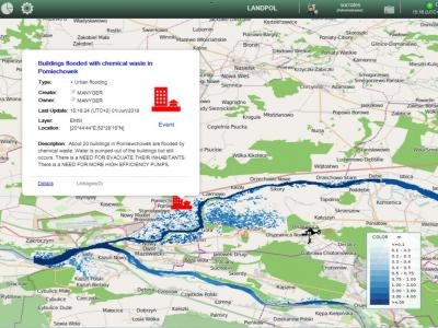
SOCRATES OC enhances analysis and decision-making capabilities by means of an improved shared situational awareness based on relevant information about the operational situation including crisis events, missions and resources.

PROTECT
Using the know-how and expertise acquired during the development of the CECIS tool, the PROTECT application is a web-based alert and notification system for emergency (and early warnings) situations concerning civil protection.
XVR On Scene
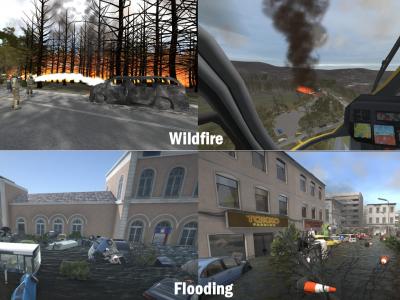
XVR On Scene provides 3D virtual reality simulation of an incident scene. Instructors can build any type of incident to educate, train or assess operational and tactical first responders and incident commanders, either individually or in teams.
ARGUS Fire
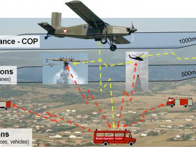
Forest Fire/Wildfire management solution based on aerial multi-sensorsystem, data processing and resources management
Copernicus Drought Observatory
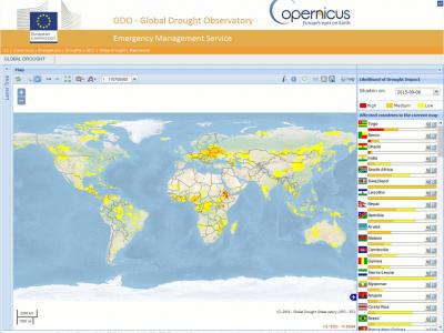
The EMS Drought Observatory (DO) provides drought-relevant information and early-warnings for Europe (EDO) and the globe (GDO). Short analytical reports (Drought News) are published in case of imminent droughts.

Rapid Mapping
DroneRapidMapping enables rapid mapping of incident/crisis area. The solution enables very fast generation of orthophoto maps based on imagery acquired by any drone (RPAS) available to rescue or crisis management actors.
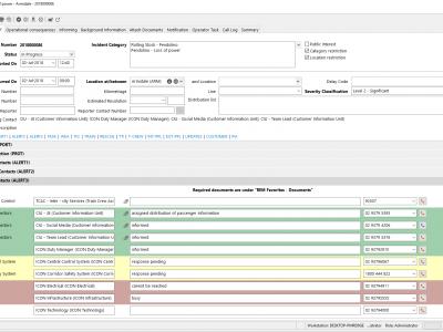
REM Railway incident management
The REM Railway incident management by Frequentis lets both on-site and off-site staff handle railway related incidents ranging from operational incidents and technical incidents to emergency and crisis situations.
Emergency Mapping Tool (EMT)
Easy to use CM Solution for sharing and visualisation of the crisis management information. Faciliates comminication even in multilingual cross-organisational ad-hoc setups
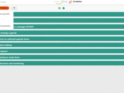
CrisisHub
CrisisHub is a web-based crisis and capacity/resource management tool designed to assist (teams of) strategic advisors before and during a crisis
zirkarta
Zirkarta gets the right information to the right people at the right time to enable geographically dispersed people to work together to achieve a common objective during a crisis.
 |
Portfolio of Solutions web site has been initially developed in the scope of DRIVER+ project. Today, the service is managed by AIT Austrian Institute of Technology GmbH., for the benefit of the European Management. PoS is endorsed and supported by the Disaster Competence Network Austria (DCNA) as well as by the STAMINA and TeamAware H2020 projects. |