As an alternative to searching directly for solutions, you can also search for CM gaps and find out which solutions address the gaps you are interested in.
PDF export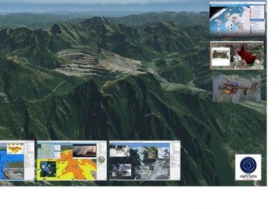
vieWTerra Evolution
vieWTerra Suite is a suite of products allowing responders to rapidly build a virtual 4D representation (3D synthetic environment+ Time dimension) of any potential Crisis area on Earth.
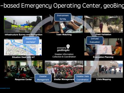
The Humanitarian ICT for Strengthening the Disaster Resilience
This humanitarian ICT solution, geoBingAn, provides the SaaS platform of emergency operation center (EOC) for developing area
3Di - Water Management
3Di is a cloud-based versatile water management instrument that enables flood forecasting and risk mapping.
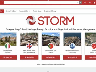
STORM
STORM Dashboard provides collaborative and operative services to better act in the prevention and intervention phases of a disaster
UAV-ASIGN
UAV-ASIGN is a software solution that helps reduce emergency and disaster response time by collecting and sending UAV photos and videos while in-flight even through low or constrained bandwidths.
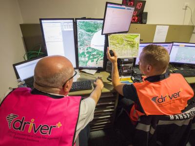
MDA command and Control system
MDA C4I system allows for efficient, real time response to tasks on the field (e.g. people in need for medical assistance), by allocating the site, allocating the resources needed and available, tasking the resources and following up the acomplishment.
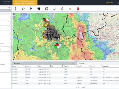
LifeX COP
LifeX COP is a web-centric multi-user Solution developed by Frequentis to address the lack of a Common Operational Picture in the field of Crisis Management.
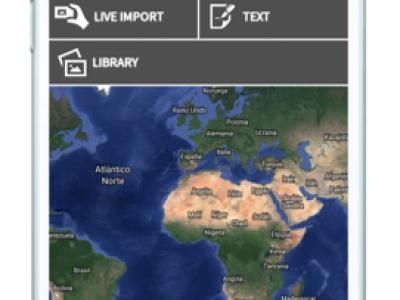
Field Data Collection
A data collection system which commonly involves dozens (if not hundreds) of people covering large, sometimes remote areas, gathering data about properties, owners and the environment
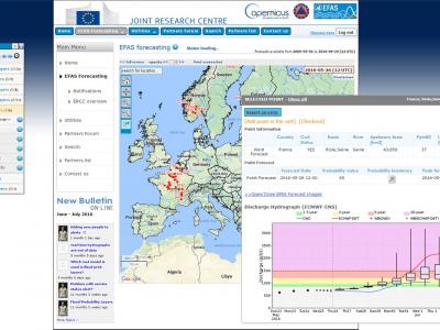
Copernicus Emergency Management Service
The Copernicus Emergency Management Service (Copernicus EMS) provides all actors involved in the management of natural disasters, man-made emergency situations, and humanitarian crises with timely and accurate geo-spatial information derived from satellit

MoreIT - Responsible Innovation and Digital Ethics Support
Tools and services for responsible innovation and digital ethics.

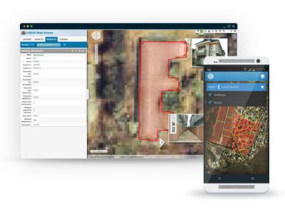
Rapid Mapping
DroneRapidMapping enables rapid mapping of incident/crisis area. The solution enables very fast generation of orthophoto maps based on imagery acquired by any drone (RPAS) available to rescue or crisis management actors.
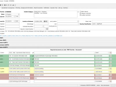
REM Railway incident management
The REM Railway incident management by Frequentis lets both on-site and off-site staff handle railway related incidents ranging from operational incidents and technical incidents to emergency and crisis situations.
IO-DA
IO-DA solution enhances situation assesment by providing different modelers.
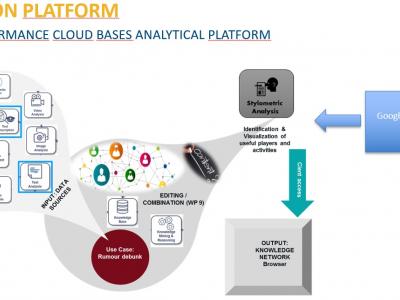
Rumour Debunker
The Rumor Debunker offers a solution for internet news analytics. It is developed to counteract mis- or disinformation campaigns.
 |
Portfolio of Solutions web site has been initially developed in the scope of DRIVER+ project. Today, the service is managed by AIT Austrian Institute of Technology GmbH., for the benefit of the European Management. PoS is endorsed and supported by the Disaster Competence Network Austria (DCNA) as well as by the STAMINA and TeamAware H2020 projects. |