As an alternative to searching directly for solutions, you can also search for CM gaps and find out which solutions address the gaps you are interested in.
PDF export
AIOSAT
The AIOSAT (Autonomous Indoor / Outdoor Safety Tracking System) system will allow the team/brigade commander to track the location, including a confidence margin on the location, answering a necessity of the emergency services.
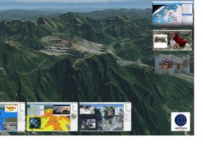
vieWTerra Evolution
vieWTerra Suite is a suite of products allowing responders to rapidly build a virtual 4D representation (3D synthetic environment+ Time dimension) of any potential Crisis area on Earth.

Evacuation & Repatriation Management Platform
Evacuation and Repatriation Management Platform (EMP)
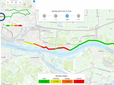
Real Time Flood Risk Assessment Viewer
In the Real Time Flood Risk Assessment viewer risk information is presented for the actual situation (using measurements) and upcoming day’s using forecasts, uses a single point of truth of information for all the daily operational working processes.
SOCRATES OC
SOCRATES OC enhances analysis and decision-making capabilities by means of an improved shared situational awareness based on relevant information about the operational situation including crisis events, missions and resources.

PROTECT
Using the know-how and expertise acquired during the development of the CECIS tool, the PROTECT application is a web-based alert and notification system for emergency (and early warnings) situations concerning civil protection.
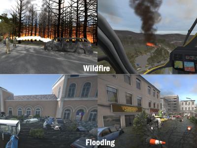
XVR On Scene
XVR On Scene provides 3D virtual reality simulation of an incident scene. Instructors can build any type of incident to educate, train or assess operational and tactical first responders and incident commanders, either individually or in teams.
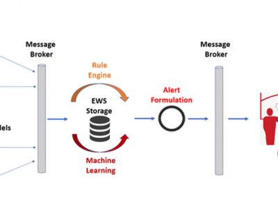
ML-Based Early Warning System
ML-Based Early Warning System is responsible to provide the necessary notifications (warnings and/or alerts) to the end users in case of potential outbreaks taking into consideration certain rules and patterns based on Machine Learning models. Support users in order to identify needs on material resources, while assist authorities to monitor and validate the effectiveness of policies and measures that are applied.
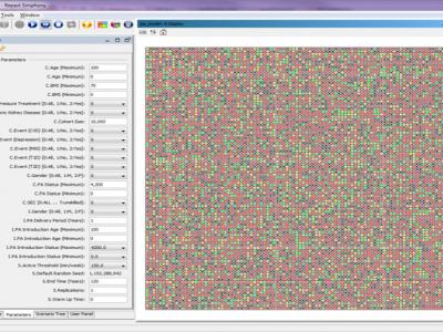
Physical Activity Lifelong Modelling & Simulation (PALMS) model
The Physical Activity Lifelong Modelling & Simulation (PALMS) model is an agent-based micro-simulation that predicts the lifelong physical activity behaviour of individuals of a population and its effect on their quality of life.
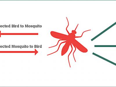
BIMS_WN West Nile epidemics model.
The BIMS_WN model is a muti-agent model whose goal is to predict the occurrence of a WN epidemic using climate and bird migration and movement data.

SARS-Cov-2 and Escherichia coli (E. coli) ESBL detection with SHERLOCK/DETECTR
Rapid detection of SARS-Cov-2 and E. coli (ESBL) via the utilisation of a portable SHERLOCK/DETECTR approach.

Real-time detection of Measles, West Nile Virus and SARS-Cov-2
Genetic markers allowing real time point-of-service detection of Measles, West Nile Virus and SARS-Cov-2 via the utilization of a portable qcLAMP device
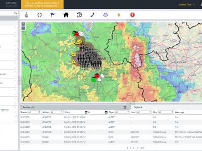
LifeX COP
LifeX COP is a web-centric multi-user Solution developed by Frequentis to address the lack of a Common Operational Picture in the field of Crisis Management.
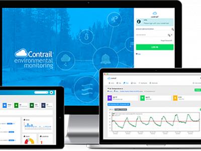
Contrail Flood Monitoring
Real-time Flood Early Warning System

COVID-19 Information and Symptom Checker chatbot
If people know the facts and check their symptoms, they can be guided on when it’s necessary to isolate themselves, visit health facilities, or continue to follow recommended practices to slow the spread of the disease.
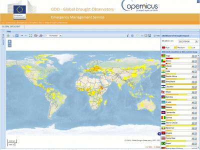
Copernicus Drought Observatory
The EMS Drought Observatory (DO) provides drought-relevant information and early-warnings for Europe (EDO) and the globe (GDO). Short analytical reports (Drought News) are published in case of imminent droughts.
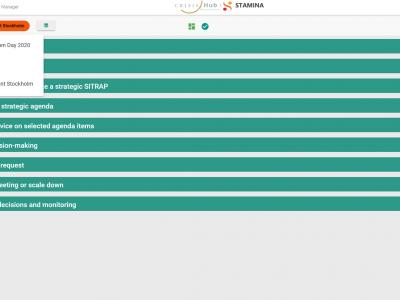
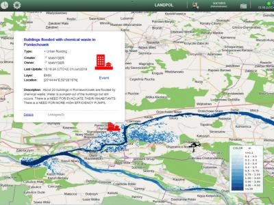
CrisisHub
CrisisHub is a web-based crisis and capacity/resource management tool designed to assist (teams of) strategic advisors before and during a crisis
zirkarta
Zirkarta gets the right information to the right people at the right time to enable geographically dispersed people to work together to achieve a common objective during a crisis.
 |
Portfolio of Solutions web site has been initially developed in the scope of DRIVER+ project. Today, the service is managed by AIT Austrian Institute of Technology GmbH., for the benefit of the European Management. PoS is endorsed and supported by the Disaster Competence Network Austria (DCNA) as well as by the STAMINA and TeamAware H2020 projects. |