As an alternative to searching directly for solutions, you can also search for CM gaps and find out which solutions address the gaps you are interested in.
PDF export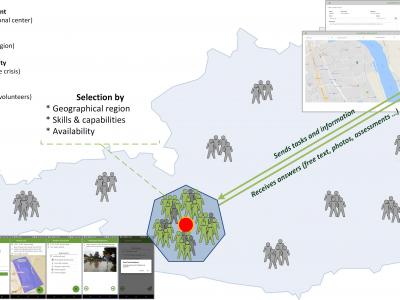
CrowdTasker
CrowdTasker enables crisis managers to instruct large numbers of non-institutional (either spontaneous or pre-registered) volunteers with customizable tasks, contextual information, warnings and alerts, as well as to crowdsource information from them.
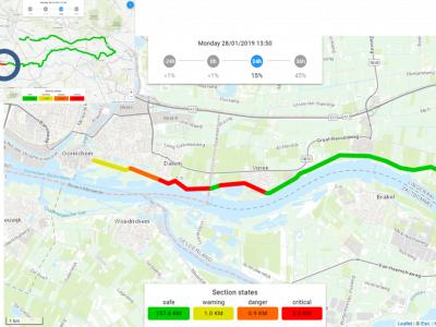
Real Time Flood Risk Assessment Viewer
In the Real Time Flood Risk Assessment viewer risk information is presented for the actual situation (using measurements) and upcoming day’s using forecasts, uses a single point of truth of information for all the daily operational working processes.
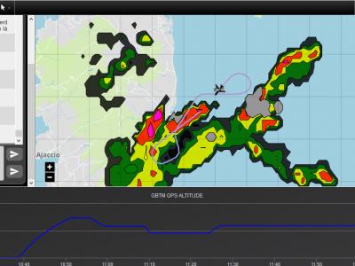
Collaborative Mission Management Service - PLANET
In crisis situation, sharing real-time information is vital! Answering this challenge, ATMOSPHERE has developed a collaborative mission management service, PLANET, which enables to communicate on board and on ground in real-time anywhere in the world.
UAV-ASIGN
UAV-ASIGN is a software solution that helps reduce emergency and disaster response time by collecting and sending UAV photos and videos while in-flight even through low or constrained bandwidths.
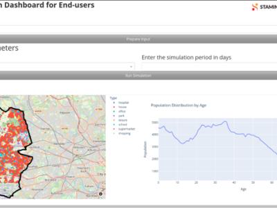
FACS - Flu And Coronavirus Simulator
Agent based modelling tool to simulate spread of flu and coronavirus in a local region
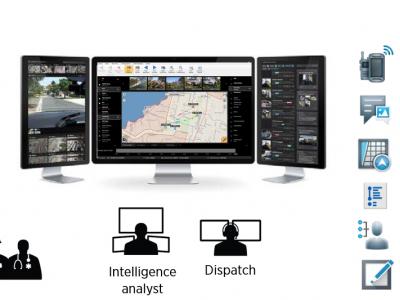
ENGAGE IMS/CAD integrated Call-Center solution
ENGAGE IMS/CAD suite is an integrated Incident & Crisis Coordination solution for public & private safety organizations

XVR Crisis Media
With XVR Crisis Media you can train how to manage and monitor communication from news media, social media and internal communication sources in a crisis situation.

Mixed Reality Glasses
Using mixed-reality glasses to train, inform and warn the first responders
AIR's Life and Health Models
AIR models help to anticipate the drivers of mortality and morbidity risk to facilitate optimal risk management, risk transfer, and risk mitigation decisions that align with organisation's strategic goals.
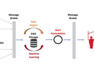
ML-Based Early Warning System
ML-Based Early Warning System is responsible to provide the necessary notifications (warnings and/or alerts) to the end users in case of potential outbreaks taking into consideration certain rules and patterns based on Machine Learning models. Support users in order to identify needs on material resources, while assist authorities to monitor and validate the effectiveness of policies and measures that are applied.
Antimicrobial Resistance Model (AIR)
AIR is a Deep Neural Network (DNN) model used for predicting the excess mortality due to antimicrobial resistance. Additionally, it incorporates patient’s contextual epidemiological and infectious information.
BIMS_WN West Nile epidemics model.
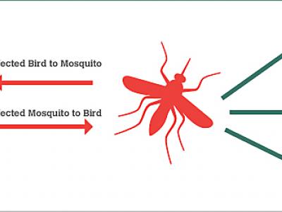
The BIMS_WN model is a muti-agent model whose goal is to predict the occurrence of a WN epidemic using climate and bird migration and movement data.

Flee - Predictive Modelling Tool
Flee is an agent-based modelling code used to model (forced) migration and other movements across country borders.
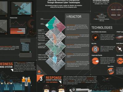
I-REACT
Due to climate change, floods, wildfires and other extreme weather events are becoming more frequent and intense. This scenario poses a challenge for current risk management systems.
MDA command and Control system
MDA C4I system allows for efficient, real time response to tasks on the field (e.g. people in need for medical assistance), by allocating the site, allocating the resources needed and available, tasking the resources and following up the acomplishment.
GINA
GINA System is a map software technology for computers, tablets and smartphones
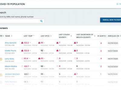
CovidMonitoring
For employers and healthcare organizations to monitor employees, patients, and other individuals
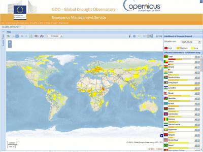
Copernicus Drought Observatory
The EMS Drought Observatory (DO) provides drought-relevant information and early-warnings for Europe (EDO) and the globe (GDO). Short analytical reports (Drought News) are published in case of imminent droughts.
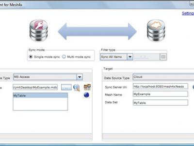
Mesh4X
Mesh4X is a set of libraries, services and applications that allow data to be synchronized across multiple applications, databases and files.

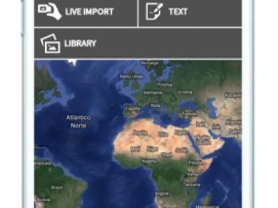
FRT - Field Reporting Tool
The Field Reporting Tool is a platform to collect and promptly share multimedia georeferenced information.
 |
Portfolio of Solutions web site has been initially developed in the scope of DRIVER+ project. Today, the service is managed by AIT Austrian Institute of Technology GmbH., for the benefit of the European Management. PoS is endorsed and supported by the Disaster Competence Network Austria (DCNA) as well as by the STAMINA and TeamAware H2020 projects. |