As an alternative to searching directly for solutions, you can also search for CM gaps and find out which solutions address the gaps you are interested in.
PDF export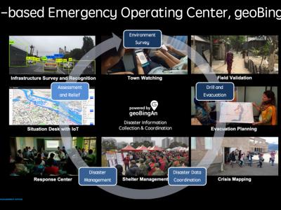
The Humanitarian ICT for Strengthening the Disaster Resilience
This humanitarian ICT solution, geoBingAn, provides the SaaS platform of emergency operation center (EOC) for developing area

STORM
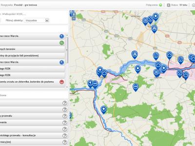
STORM Dashboard provides collaborative and operative services to better act in the prevention and intervention phases of a disaster
UAV-ASIGN
UAV-ASIGN is a software solution that helps reduce emergency and disaster response time by collecting and sending UAV photos and videos while in-flight even through low or constrained bandwidths.
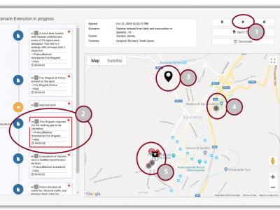
Preparedness Pandemic Training tool (PPT)
This is a scenario builder tool, in which a trainer is able to create simple or complex training scenarios and execute them in order to perform exercises

CAE GESI-SiTA Classroom Trainer
The CAE GESI-SiTA classroom trainer offers a unique foundation to experience and learn tactical basics at a new level of detail and interactivity.

XVR Crisis Media
With XVR Crisis Media you can train how to manage and monitor communication from news media, social media and internal communication sources in a crisis situation.

Mixed Reality Glasses
Using mixed-reality glasses to train, inform and warn the first responders
CAE GESI
CAE GESI provides an environment for emergency managers and their staff to plan, test, and train their response strategies in a safe and controlled environment.
XVR On Scene
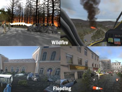
XVR On Scene provides 3D virtual reality simulation of an incident scene. Instructors can build any type of incident to educate, train or assess operational and tactical first responders and incident commanders, either individually or in teams.

mHero
a two-way, mobile phone-based communication system that uses basic text messaging, or SMS, to connect ministries of health and health workers. mHero operates on simple talk-and-text mobile devices—no smartphone or tablet required.
Preparedness for Decision Making in Crisis
PROCeed is a computer system which prepares its users for proper decision-making in crisis situations.
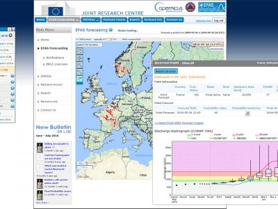
Copernicus Emergency Management Service
The Copernicus Emergency Management Service (Copernicus EMS) provides all actors involved in the management of natural disasters, man-made emergency situations, and humanitarian crises with timely and accurate geo-spatial information derived from satellit

MoreIT - Responsible Innovation and Digital Ethics Support
Tools and services for responsible innovation and digital ethics.

Rapid Mapping
DroneRapidMapping enables rapid mapping of incident/crisis area. The solution enables very fast generation of orthophoto maps based on imagery acquired by any drone (RPAS) available to rescue or crisis management actors.
Scenario Building Tool
A dynamic tool regarding multiple hazard scenarios simulation for the training civil protection actors
 |
Portfolio of Solutions web site has been initially developed in the scope of DRIVER+ project. Today, the service is managed by AIT Austrian Institute of Technology GmbH., for the benefit of the European Management. PoS is endorsed and supported by the Disaster Competence Network Austria (DCNA) as well as by the STAMINA and TeamAware H2020 projects. |