As an alternative to searching directly for solutions, you can also search for CM gaps and find out which solutions address the gaps you are interested in.
PDF export
Evacuation & Repatriation Management Platform
Evacuation and Repatriation Management Platform (EMP)
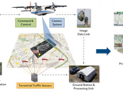
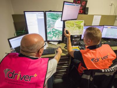
Airborne and Terrestrial Situational Awareness
The solution “Airborne and Terrestrial Situational Awareness” is composed of several individual components and tools, which are integrated into a complete system, ready to be deployed in different scenarios. The systems can also be used in combination.
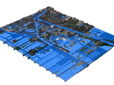
3Di - Water Management
3Di is a cloud-based versatile water management instrument that enables flood forecasting and risk mapping.
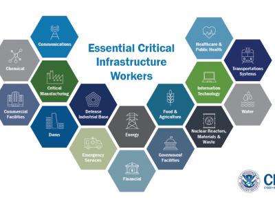
US Guidance on the Essential Critical Infrastructure Workforce during COVID-19
Guidance for identifying the critical infrastructure sectors and the essential workers needed to maintain the critical services and functions during the COVID-19 pandemic response

Google Forms
Google Forms is a survey administration software included as part of the free, web-based Google Docs Editors suite offered by Google. The service also includes Google Docs, Google Sheets, Google Slides, Google Drawings, Google Sites, and Google Keep. Google Forms is only available as a web application. The app allows users to create and edit surveys online while collaborating with other users in real-time. The collected information can be automatically entered into a spreadsheet.

SurveyMonkey
SurveyMonkey is an online survey development cloud-based software as a service company providing an online survey tool for organizations. It offers data analysis, sample selection, bias elimination, and data representation tools.
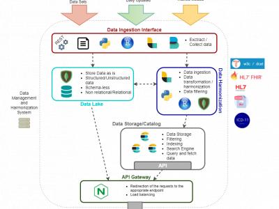
Data Management & Harmonization Tool (DMHT)
DMHT is a technological platform for aggregating heterogeneous, mostly curated, and structured anonymized historical health and other relevant data sets and their annotations from health stakeholders, as well as open data sets.
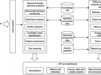
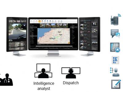
Web and Social Media Analytics (WSMA)
Tool for crawling, monitoring and processing of web and social media content and users activity
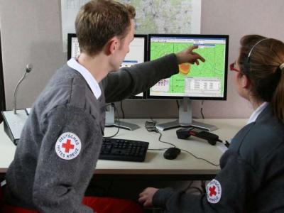
CAE GESI
CAE GESI provides an environment for emergency managers and their staff to plan, test, and train their response strategies in a safe and controlled environment.
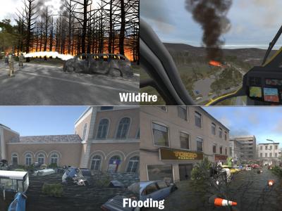
XVR On Scene
XVR On Scene provides 3D virtual reality simulation of an incident scene. Instructors can build any type of incident to educate, train or assess operational and tactical first responders and incident commanders, either individually or in teams.
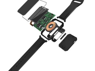
SmarKo Wearable Monitoring Tool
SmarKo, a smart wearble sensor device, that enables remote real time monitoring of health, environmental and physical activity data as well as geolocation and can transmit the measurement data to a mobile app.
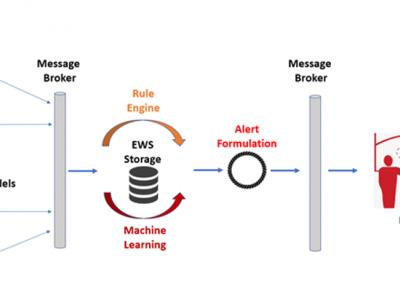
ML-Based Early Warning System
ML-Based Early Warning System is responsible to provide the necessary notifications (warnings and/or alerts) to the end users in case of potential outbreaks taking into consideration certain rules and patterns based on Machine Learning models. Support users in order to identify needs on material resources, while assist authorities to monitor and validate the effectiveness of policies and measures that are applied.

mHero
a two-way, mobile phone-based communication system that uses basic text messaging, or SMS, to connect ministries of health and health workers. mHero operates on simple talk-and-text mobile devices—no smartphone or tablet required.
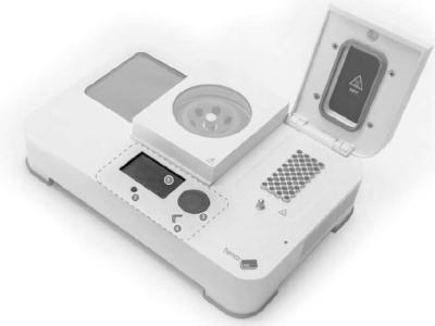
ESBL detect
Portable PCR device for on site detection of bacteria
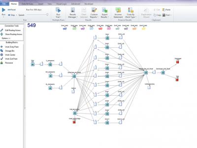
CHARM dynamiC Hospital wARd Management
dynamiC Hospital wARd Management (CHARM) is a discrete-event simulation (DES) that models dynamic reconfiguration of hospital wards for bed capacity planning facilitating continuation of normal Intensive Care Unit (ICU) operations during disease outbreaks.
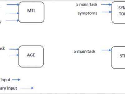
Antimicrobial Resistance Model (AIR)
AIR is a Deep Neural Network (DNN) model used for predicting the excess mortality due to antimicrobial resistance. Additionally, it incorporates patient’s contextual epidemiological and infectious information.
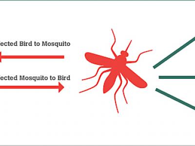
BIMS_WN West Nile epidemics model.
The BIMS_WN model is a muti-agent model whose goal is to predict the occurrence of a WN epidemic using climate and bird migration and movement data.
MDA command and Control system
MDA C4I system allows for efficient, real time response to tasks on the field (e.g. people in need for medical assistance), by allocating the site, allocating the resources needed and available, tasking the resources and following up the acomplishment.
GINA
GINA System is a map software technology for computers, tablets and smartphones
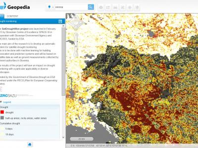
Drought Monitoring Portal
Automatic system for satellite drought monitoring
 |
Portfolio of Solutions web site has been initially developed in the scope of DRIVER+ project. Today, the service is managed by AIT Austrian Institute of Technology GmbH., for the benefit of the European Management. PoS is endorsed and supported by the Disaster Competence Network Austria (DCNA) as well as by the STAMINA and TeamAware H2020 projects. |