As an alternative to searching directly for solutions, you can also search for CM gaps and find out which solutions address the gaps you are interested in.
PDF export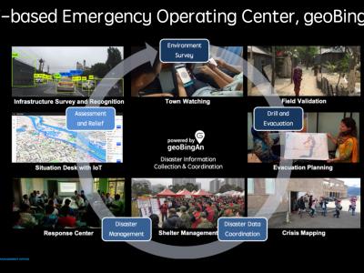
The Humanitarian ICT for Strengthening the Disaster Resilience
This humanitarian ICT solution, geoBingAn, provides the SaaS platform of emergency operation center (EOC) for developing area

STORM
STORM Dashboard provides collaborative and operative services to better act in the prevention and intervention phases of a disaster
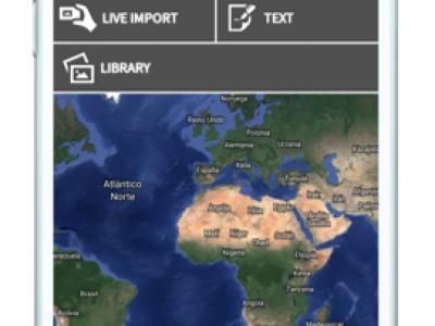
UAV-ASIGN
UAV-ASIGN is a software solution that helps reduce emergency and disaster response time by collecting and sending UAV photos and videos while in-flight even through low or constrained bandwidths.
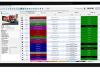
ENGAGE IMS/CAD integrated Call-Center solution
ENGAGE IMS/CAD suite is an integrated Incident & Crisis Coordination solution for public & private safety organizations
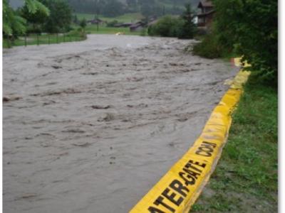
Emergency flood protection for cities | Water-Gate© Flexible dams
Prevent flooding in all circumstances. Water-Gate© is a flexible emergency flood dam that harnesses the power of floodwater or firewater to automatically fill, unfold and stabilise itself.
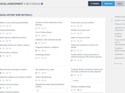
E-PHR
The aim of the electronic Personal Health Record (e-PHR) and its platform is to enhance knowledge amongst stakeholders about refugees’ and migrants’ health needs

eCEBS
eCEBS enables community level lookouts to report unusual health events in human/animal populations. Built on DHIS2 Tracker module it relies on coded SMS to report and confirm events.
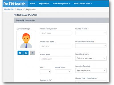
Re-Health
The aim of the IOM e-PH is to ensure that migrant health assessment records are available and to strengthen national and cross-border disease surveillance and response capacities.
Copernicus Emergency Management Service
The Copernicus Emergency Management Service (Copernicus EMS) provides all actors involved in the management of natural disasters, man-made emergency situations, and humanitarian crises with timely and accurate geo-spatial information derived from satellit
Mental Health and Psychosocial Support (MHPSS)
OPSIC designed and developed a comprehensive operational guidance system (COMPASS) that provided an integrated single platform for practical MHPSS guidance in crisis management.

MoreIT - Responsible Innovation and Digital Ethics Support
Tools and services for responsible innovation and digital ethics.

Rapid Mapping
DroneRapidMapping enables rapid mapping of incident/crisis area. The solution enables very fast generation of orthophoto maps based on imagery acquired by any drone (RPAS) available to rescue or crisis management actors.
 |
Portfolio of Solutions web site has been initially developed in the scope of DRIVER+ project. Today, the service is managed by AIT Austrian Institute of Technology GmbH., for the benefit of the European Management. PoS is endorsed and supported by the Disaster Competence Network Austria (DCNA) as well as by the STAMINA and TeamAware H2020 projects. |