As an alternative to searching directly for solutions, you can also search for CM gaps and find out which solutions address the gaps you are interested in.
PDF export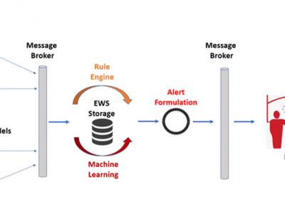
ML-Based Early Warning System
ML-Based Early Warning System is responsible to provide the necessary notifications (warnings and/or alerts) to the end users in case of potential outbreaks taking into consideration certain rules and patterns based on Machine Learning models. Support users in order to identify needs on material resources, while assist authorities to monitor and validate the effectiveness of policies and measures that are applied.
ESBL detect
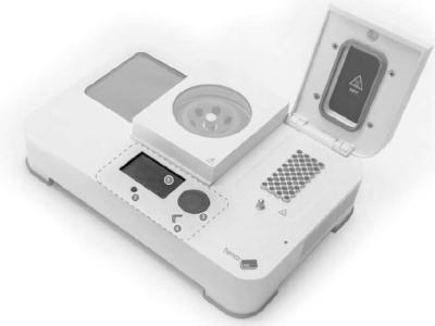
Portable PCR device for on site detection of bacteria
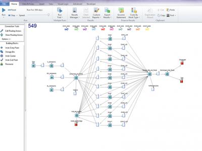
CHARM dynamiC Hospital wARd Management
dynamiC Hospital wARd Management (CHARM) is a discrete-event simulation (DES) that models dynamic reconfiguration of hospital wards for bed capacity planning facilitating continuation of normal Intensive Care Unit (ICU) operations during disease outbreaks.
Antimicrobial Resistance Model (AIR)
AIR is a Deep Neural Network (DNN) model used for predicting the excess mortality due to antimicrobial resistance. Additionally, it incorporates patient’s contextual epidemiological and infectious information.
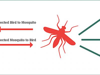
BIMS_WN West Nile epidemics model.
The BIMS_WN model is a muti-agent model whose goal is to predict the occurrence of a WN epidemic using climate and bird migration and movement data.
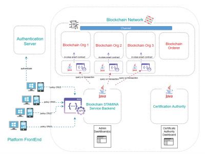
Information Protection and Secure Data Sharing Blockchain Tool
An access control policy management framework implemented by capitalizing on the Blockchain technology

SARS-Cov-2 and Escherichia coli (E. coli) ESBL detection with SHERLOCK/DETECTR
Rapid detection of SARS-Cov-2 and E. coli (ESBL) via the utilisation of a portable SHERLOCK/DETECTR approach.
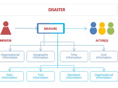
Preparedness for Decision Making in Crisis
PROCeed is a computer system which prepares its users for proper decision-making in crisis situations.
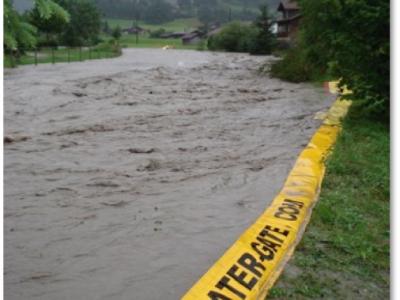
Emergency flood protection for cities | Water-Gate© Flexible dams
Prevent flooding in all circumstances. Water-Gate© is a flexible emergency flood dam that harnesses the power of floodwater or firewater to automatically fill, unfold and stabilise itself.
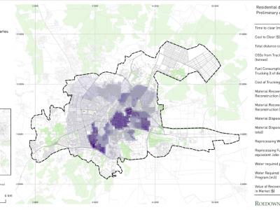
Debris Tool
The Debris Tool is a software based solution designed to amalgamate various defined inputs from the field, historic survey data and other sources, for the prediction and modelling of waste and debris removal options in a post-crisis environment.
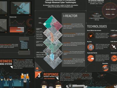
I-REACT
Due to climate change, floods, wildfires and other extreme weather events are becoming more frequent and intense. This scenario poses a challenge for current risk management systems.
EPISECC Inventory
The EPISECC Inventory is designed for the analysis of the management of selected past disasters with specific focus on interoperability and efficiency
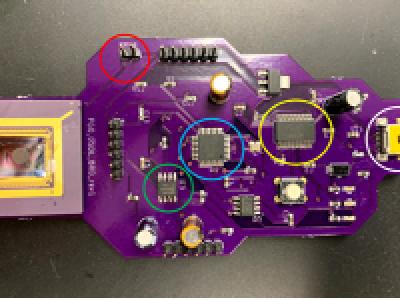
Influenza A (H1N1) on-site detection (POCT)
On-site detection of Influenza A (H1N1) with a portable qPCR device (POC)

GDACSmobile
GDACSmobile is a support platform for collecting and sharing situational awareness information. It aims to serve two main target groups with different rights and roles: people concerned with disaster relief and the (affected) population itself.

Contrail Flood Monitoring
Real-time Flood Early Warning System

Surveda
Mobile surveys by text, voice or web
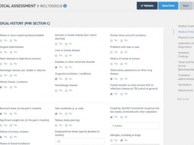
E-PHR
The aim of the electronic Personal Health Record (e-PHR) and its platform is to enhance knowledge amongst stakeholders about refugees’ and migrants’ health needs
Field Data Collection
A data collection system which commonly involves dozens (if not hundreds) of people covering large, sometimes remote areas, gathering data about properties, owners and the environment

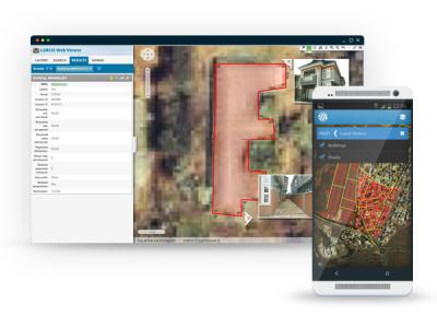
Satellite imagery archive within GIS in the Cloud
Access to processed and analysis-ready Sentinel (Earth Observation) imagery
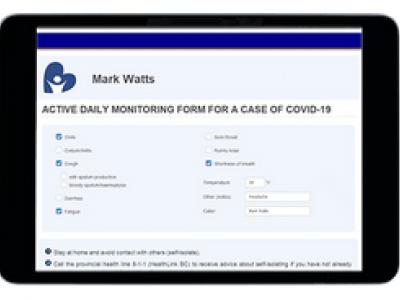
Covid-19 Monitoring
Cloud-based application for monitoring people during self-isolation with probable or confirmed COVID-19 infection.
 |
Portfolio of Solutions web site has been initially developed in the scope of DRIVER+ project. Today, the service is managed by AIT Austrian Institute of Technology GmbH., for the benefit of the European Management. PoS is endorsed and supported by the Disaster Competence Network Austria (DCNA) as well as by the STAMINA and TeamAware H2020 projects. |