As an alternative to searching directly for solutions, you can also search for CM gaps and find out which solutions address the gaps you are interested in.
PDF export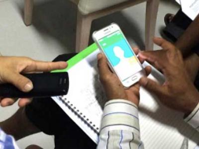
Surveda
Mobile surveys by text, voice or web
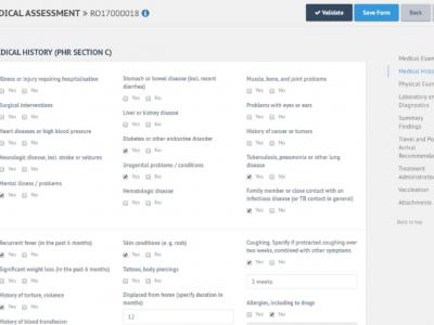
E-PHR
The aim of the electronic Personal Health Record (e-PHR) and its platform is to enhance knowledge amongst stakeholders about refugees’ and migrants’ health needs
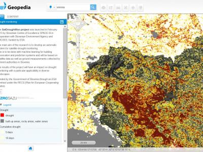
Drought Monitoring Portal
Automatic system for satellite drought monitoring
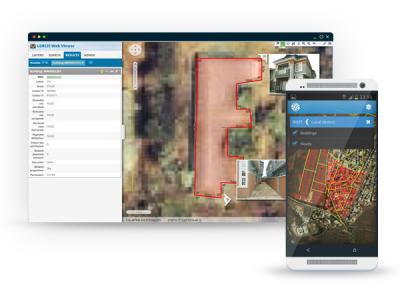
Field Data Collection
A data collection system which commonly involves dozens (if not hundreds) of people covering large, sometimes remote areas, gathering data about properties, owners and the environment

COVID-19 Information and Symptom Checker chatbot
If people know the facts and check their symptoms, they can be guided on when it’s necessary to isolate themselves, visit health facilities, or continue to follow recommended practices to slow the spread of the disease.
Satellite imagery archive within GIS in the Cloud
Access to processed and analysis-ready Sentinel (Earth Observation) imagery
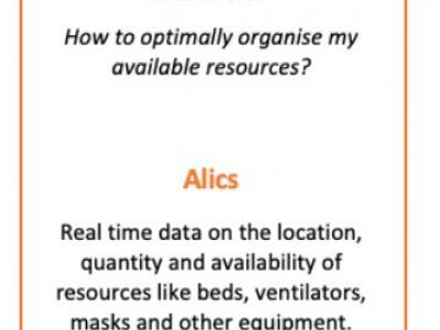
Alics
Real time data on the locaiton, quantity and availability of resources like beds, ventilators, masks and other equiptment.
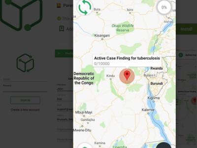
MediScout
Enable collaborative interventions to be planned, implemented and monitored.
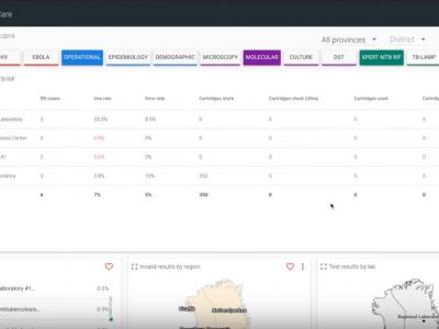
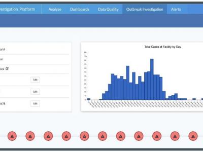
DataToCare
DataToCare connects your remote laboratories, provides you with relevant insights through graphics and reports, and manages your inventory and quality maintenance
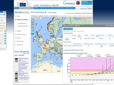
Copernicus Emergency Management Service
The Copernicus Emergency Management Service (Copernicus EMS) provides all actors involved in the management of natural disasters, man-made emergency situations, and humanitarian crises with timely and accurate geo-spatial information derived from satellit
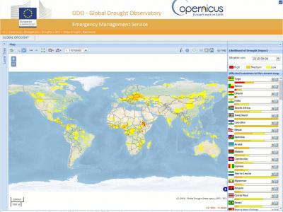
Copernicus Drought Observatory
The EMS Drought Observatory (DO) provides drought-relevant information and early-warnings for Europe (EDO) and the globe (GDO). Short analytical reports (Drought News) are published in case of imminent droughts.
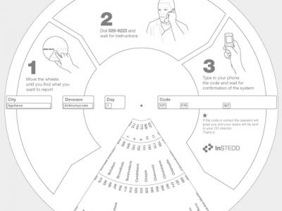
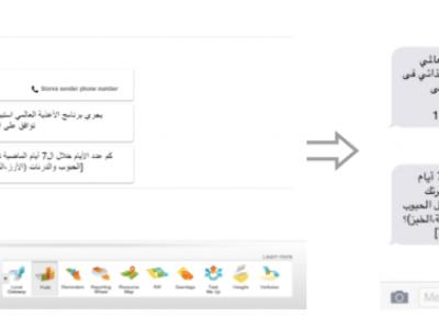
Reporting Wheel
Encode disease reports to send over mobile phones
Planwise
Identify where help is needed most - transparent, data-driven analysis for decision makers
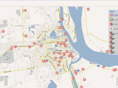
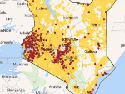
Resource Map
Resource Map helps people track their work, resources and results geographically in a collaborative environment accessible from anywhere. Set up a facility registry in minutes.
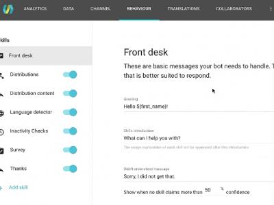
AIDA Chatbot Builder
Create interactive chatbots that can engage populations on popular chat apps like Facebook messenger.
Pollit
Free, open-source tool for conducting polls using text messages.
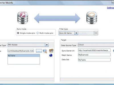
Mesh4X
Mesh4X is a set of libraries, services and applications that allow data to be synchronized across multiple applications, databases and files.
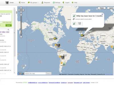
Geochat
Lets team members interact to maintain shared geospatial awareness of who is doing what where — over any device, on any platform, over any network.
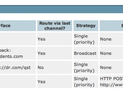
Nuntium
Set of services and clients that allow anyone to build SMS-based applications with uses that range from simple modem-based needs to countrywide deployments integrated with wireless operators.
Harmony
Readily deployable virtual workspace where critical data can be used for immediate, lifesaving decisions in the COVID-19 response.
 |
Portfolio of Solutions web site has been initially developed in the scope of DRIVER+ project. Today, the service is managed by AIT Austrian Institute of Technology GmbH., for the benefit of the European Management. PoS is endorsed and supported by the Disaster Competence Network Austria (DCNA) as well as by the STAMINA and TeamAware H2020 projects. |