As an alternative to searching directly for solutions, you can also search for CM gaps and find out which solutions address the gaps you are interested in.
PDF export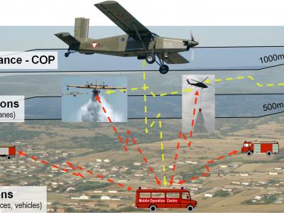
ARGUS Fire
Forest Fire/Wildfire management solution based on aerial multi-sensorsystem, data processing and resources management
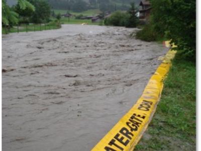
Emergency flood protection for cities | Water-Gate© Flexible dams
Prevent flooding in all circumstances. Water-Gate© is a flexible emergency flood dam that harnesses the power of floodwater or firewater to automatically fill, unfold and stabilise itself.
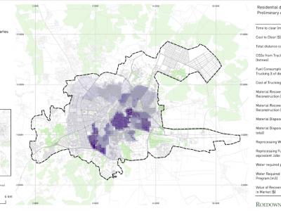
Debris Tool
The Debris Tool is a software based solution designed to amalgamate various defined inputs from the field, historic survey data and other sources, for the prediction and modelling of waste and debris removal options in a post-crisis environment.
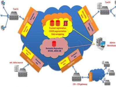
EPISECC CIS
Common Information Space as Enabler for Collaboration in Disaster Management
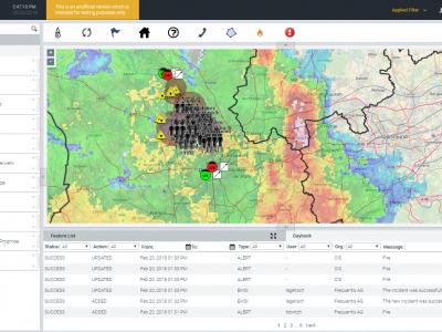
LifeX COP
LifeX COP is a web-centric multi-user Solution developed by Frequentis to address the lack of a Common Operational Picture in the field of Crisis Management.
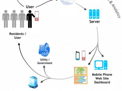
Crowdsourcing for Water Monitoring
Methodology for crowdsourcing water quality data
SIM-CI
SIM-CI provides an overview of the critical infrastructures (electricity, gas, water, telecom, internet, road, traffic networks) that will be affected by disruptive events such as floodings or a cyber-attacks.
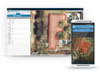
GINA
GINA System is a map software technology for computers, tablets and smartphones
Surveda
Mobile surveys by text, voice or web
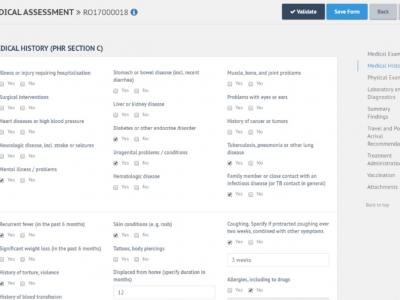
E-PHR
The aim of the electronic Personal Health Record (e-PHR) and its platform is to enhance knowledge amongst stakeholders about refugees’ and migrants’ health needs
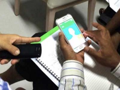
Field Data Collection
A data collection system which commonly involves dozens (if not hundreds) of people covering large, sometimes remote areas, gathering data about properties, owners and the environment

COVID-19 Information and Symptom Checker chatbot
If people know the facts and check their symptoms, they can be guided on when it’s necessary to isolate themselves, visit health facilities, or continue to follow recommended practices to slow the spread of the disease.
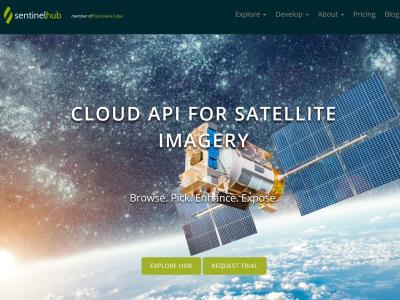
Satellite imagery archive within GIS in the Cloud
Access to processed and analysis-ready Sentinel (Earth Observation) imagery
InteleSafe
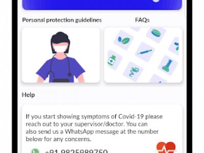
An app and website for health workers to learn how to stay safe while on the job.
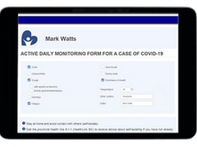
Covid-19 Monitoring
Cloud-based application for monitoring people during self-isolation with probable or confirmed COVID-19 infection.
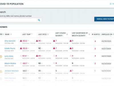
CovidMonitoring
For employers and healthcare organizations to monitor employees, patients, and other individuals

GetWell Loop
Engage all patients across their care journey through automated virtual check-ins.
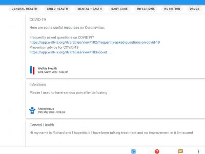
Wellvis Health Platform
Ask any health questions and get personalized answers for free from licensed doctors
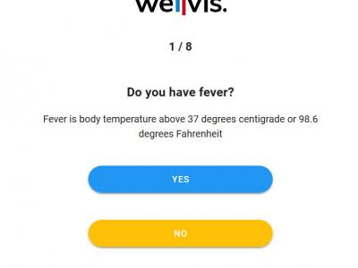
Wellvis COVID-19
Use this tool to find out your risk level to COVID-19 whether it is low, high, or medium.
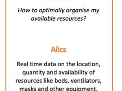
Alics
Real time data on the locaiton, quantity and availability of resources like beds, ventilators, masks and other equiptment.
 |
Portfolio of Solutions web site has been initially developed in the scope of DRIVER+ project. Today, the service is managed by AIT Austrian Institute of Technology GmbH., for the benefit of the European Management. PoS is endorsed and supported by the Disaster Competence Network Austria (DCNA) as well as by the STAMINA and TeamAware H2020 projects. |