Contact
Provider(s):
LCMS is used by all 25 safety regions, the majority of the waterboards, Rijkswaterstaat, an increasing number of health care organisations, the Royal Military Police and some drinking water providers. LCMS supports netcentric collaboration, which is a way of working in which clear agreements are made about sharing information so that decision-making under ( ) circumstances is always based on an up-to-date, consistent and common operational picture. LCMS is a web based collaboration environment with a very high level of availability. The environment can be used to share information within an as well as between organisations. It supports maintaining and sharing geographical as well as textual pictures.
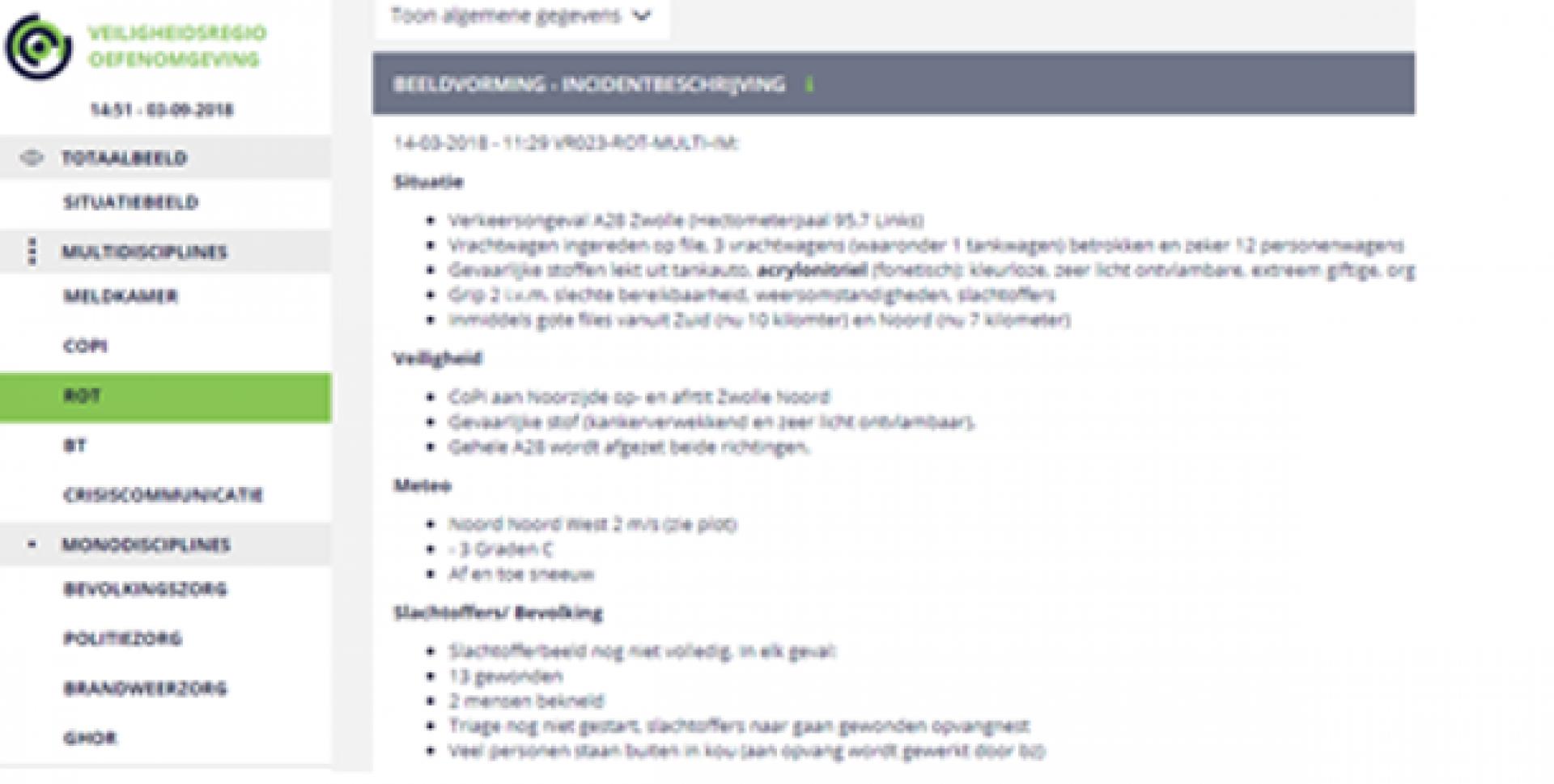
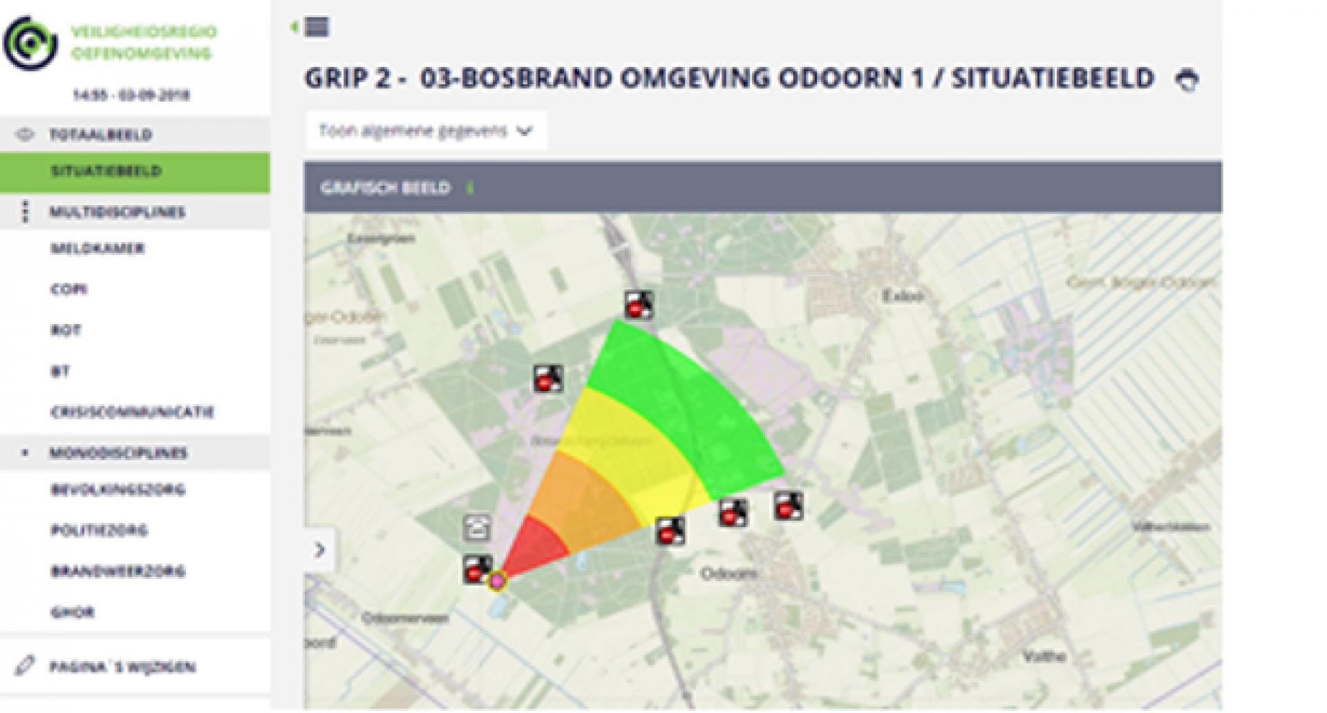
The situational picture is the heart of LCMS. This picture gives a quick overview of all relevant information from and for all collaborating teams and organisations. It consists of a geographical part and a textual part.
LCMS Text can be used to compose and arrange a coherent, clear and actual situational picture. As a reminder for the information managers, the default content of the textual fields includes a number of themes that are typically relevant in . Think of meteorological information, safety of workers and victim overview for example.
LCMS Plot can be used to maintain a geographical picture of the situation. For each participating team a separate drawing layer is available.
A web-based geographical viewer is part of LCMS Text. This viewer can be used to display relevant map layers and plot layers.
The Geo4OOV server supplies LCMS – as well as an increasing number of other systems – with non-dynamic geographical data. LCMS users can find virtually anything they .
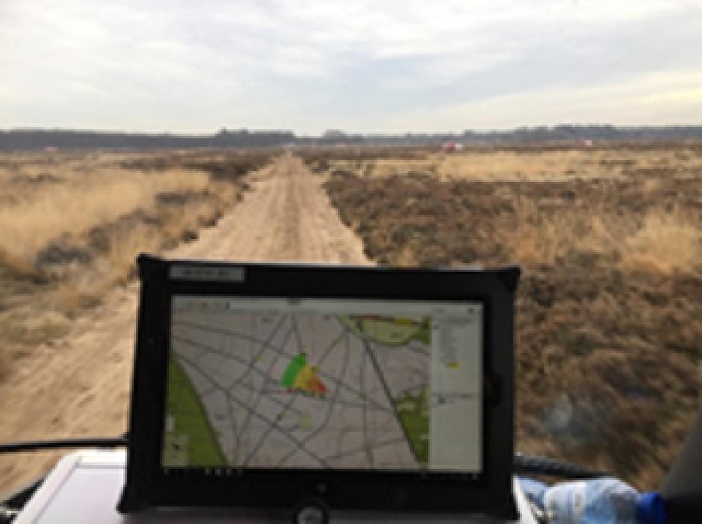
LCMS mobile supports coordination of large-scale to wild-fires. LCMS mobile complements the visualisation of incident location, firefighting locations, fire control lines, water extraction points with functionality for command and control of units, vehicles and materiel. Unit commanders are supported with real-time visualisation of actual vehicle locations, deployment locations and logistic points of interest.
LCMS mobile makes use of Ad-Hoc Routers (AHR) to maintain a secure connection with the Internet and the central LCMS servers. The AHRs automatically set up a local field network in which all vehicles are included. This has the advantage that just one of the vehicles needs a 4G, 3G or satellite connection to provide all vehicles with an Internet connection.

 |
Portfolio of Solutions web site has been initially developed in the scope of DRIVER+ project. Today, the service is managed by AIT Austrian Institute of Technology GmbH., for the benefit of the European Management. PoS is endorsed and supported by the Disaster Competence Network Austria (DCNA) as well as by the STAMINA and TeamAware H2020 projects. |